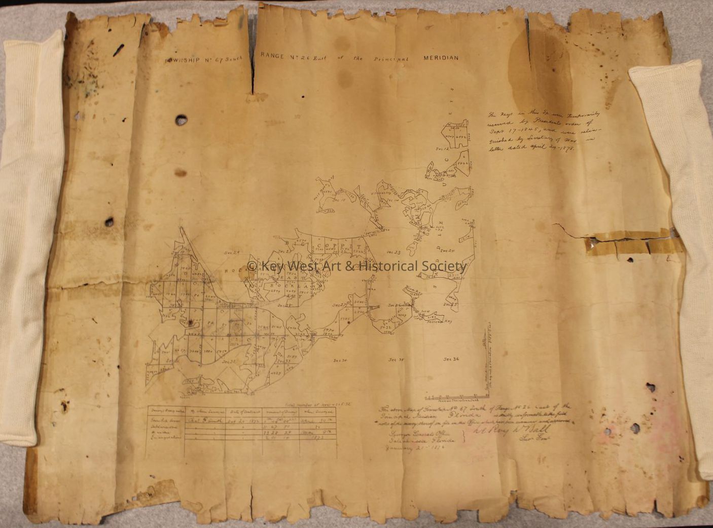
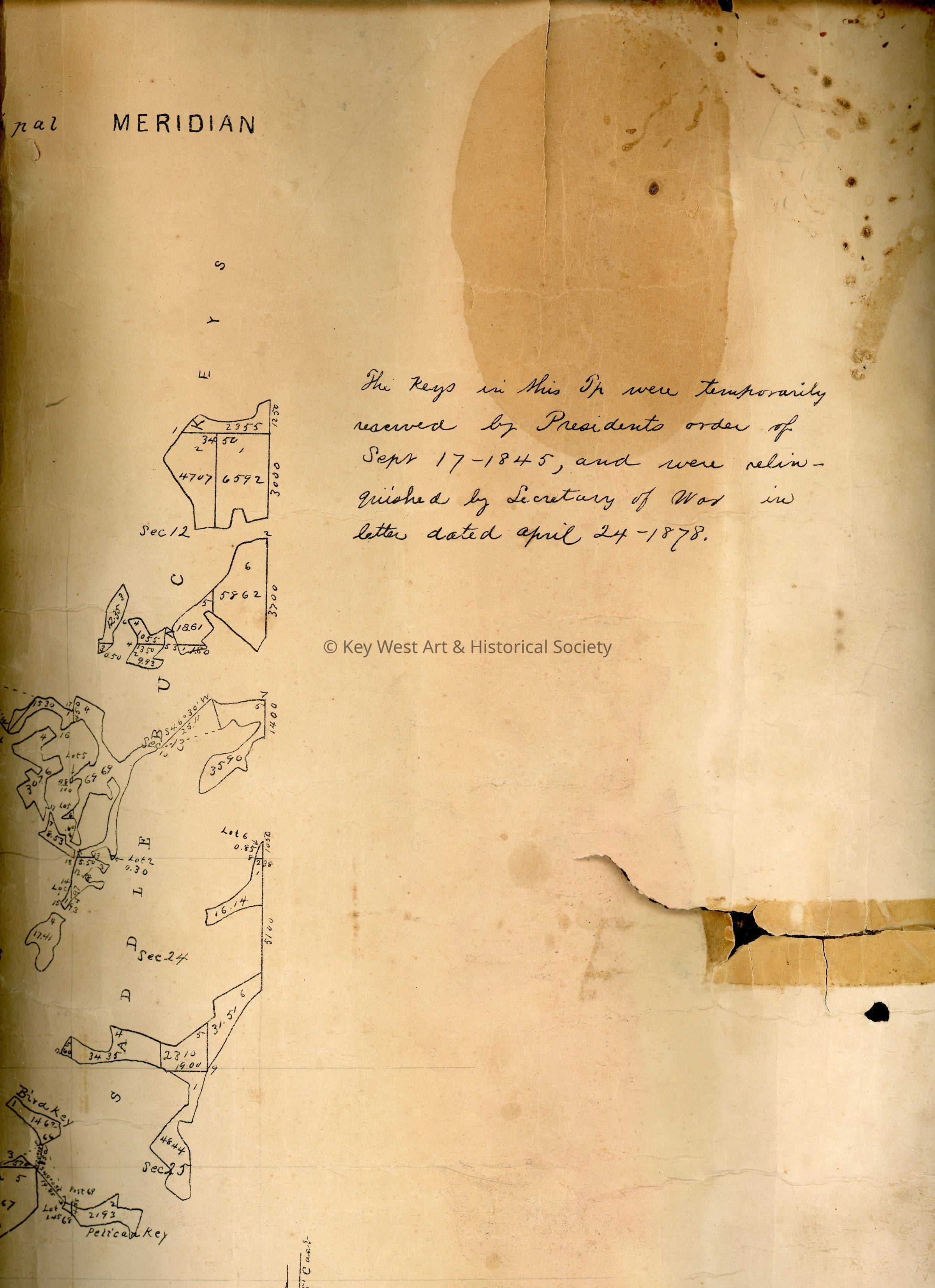
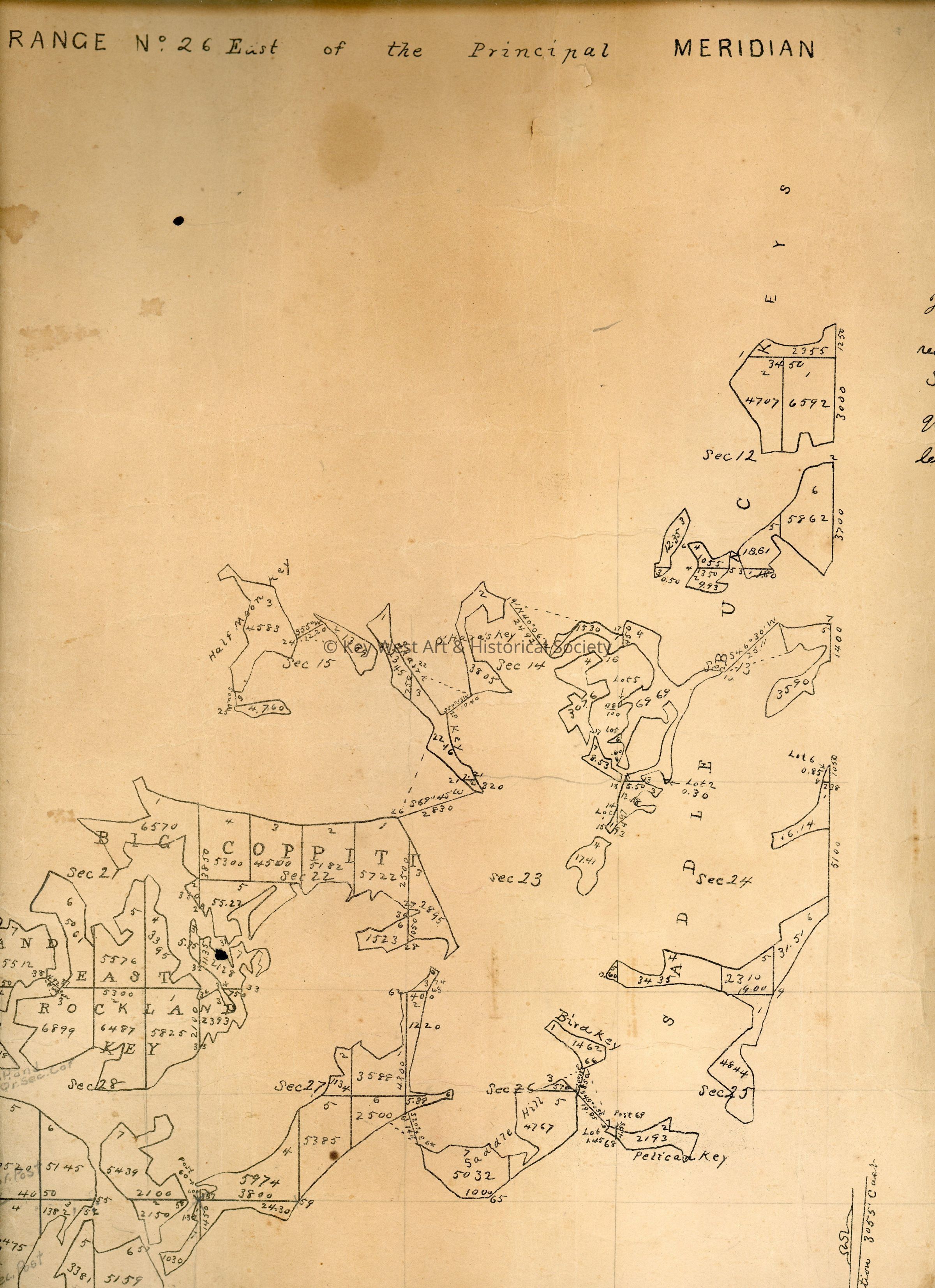
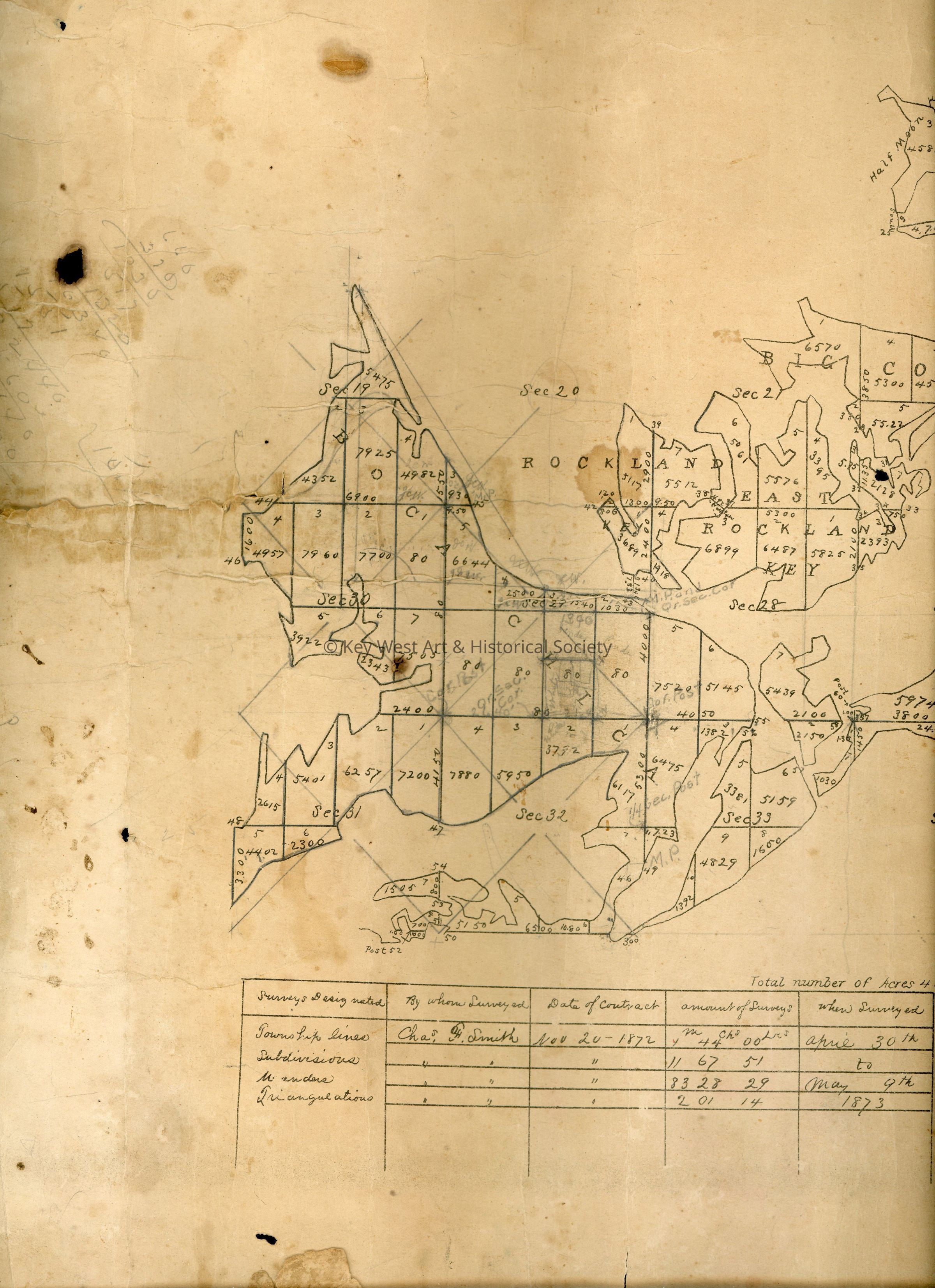
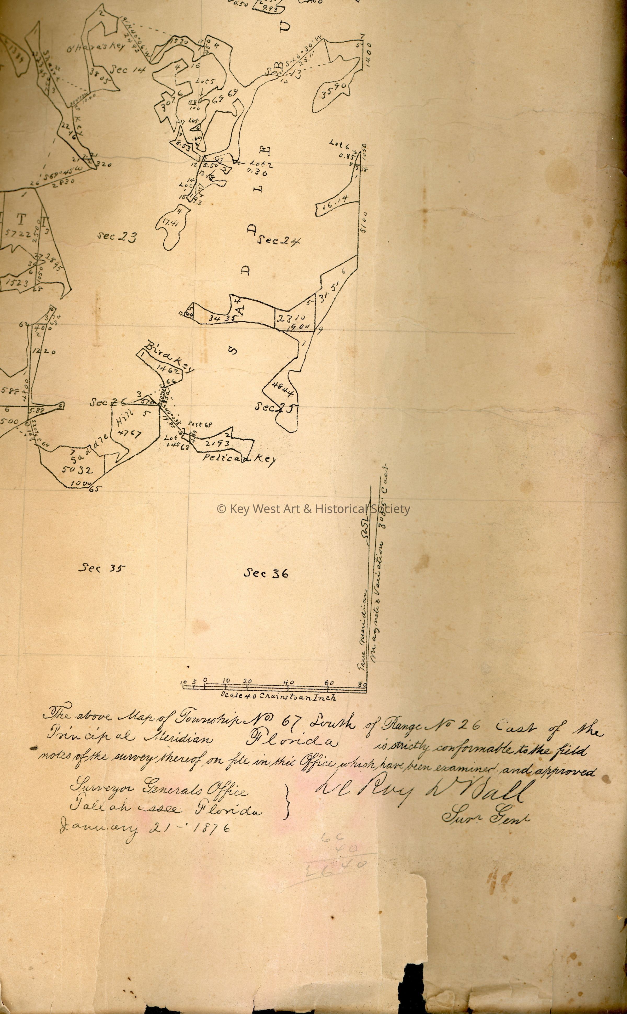
Map of Township No. 67 South of Range No. 26 East of the Principal Meridian
Entry/Object ID
2022.09.0003
Scope and Content
Plat Map of Township No. 67 South of Range No. 26 East of the Principal Meridian. The survey map runs from the Saddlebunch Keys to Boca Chica Key. The map also has a note on how the land was 'relinquished by Secretary of War in letter dated April 24-1878.'