HUB
Collections
Classifications
About
App
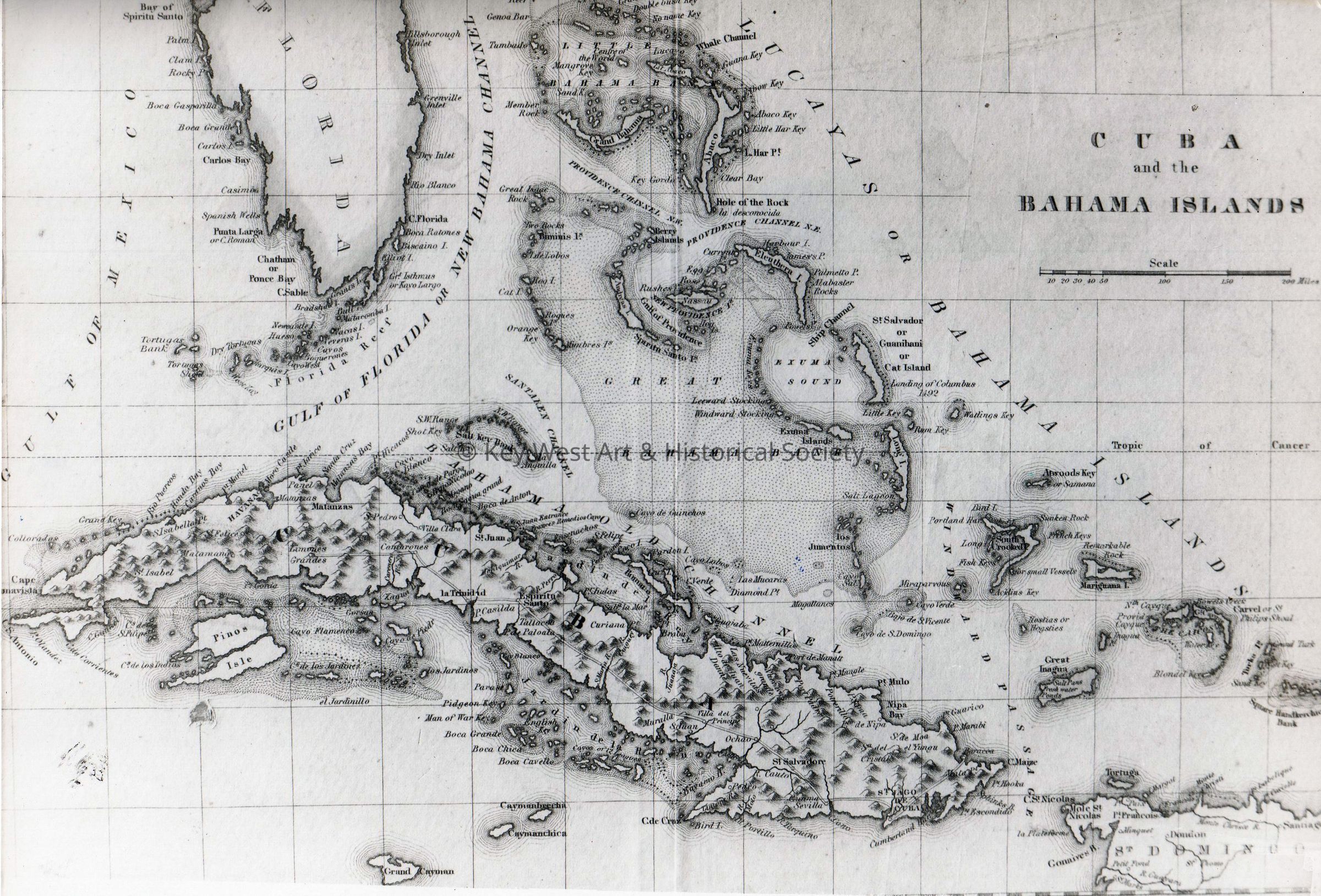
Map of Florida, Cuba and The Bahamas
Photograph
-
Key West Art & Historical Society
Map of Florida, Cuba and The Bahamas
© Key West Art & Historical Society
Name/Title
Map of Florida, Cuba and The Bahamas
Entry/Object ID
2016.22.0585
Description
Black and white photograph of a map depicting the south portion of the Florida peninsula, Cuba and The Bahamas.
Photograph Details
Subject Place
Country
Cuba,
The Bahamas,
United States of America
Continent
North America
State/Province
Florida
Collection
Photograph Collection
Made/Created
Date made
circa 1850
Time Period
19th Century
Lexicon
Nomenclature 4.0
Nomenclature Secondary Object Term
Photograph, Black-and-White
Nomenclature Primary Object Term
Photograph
Nomenclature Sub-Class
Graphic Documents
Nomenclature Class
Documentary Objects
Nomenclature Category
Category 08: Communication Objects
Dimensions
Height
8 in
Width
10 in
Condition
Reason for Exam
At Acquisition
Overall Condition
Very Good