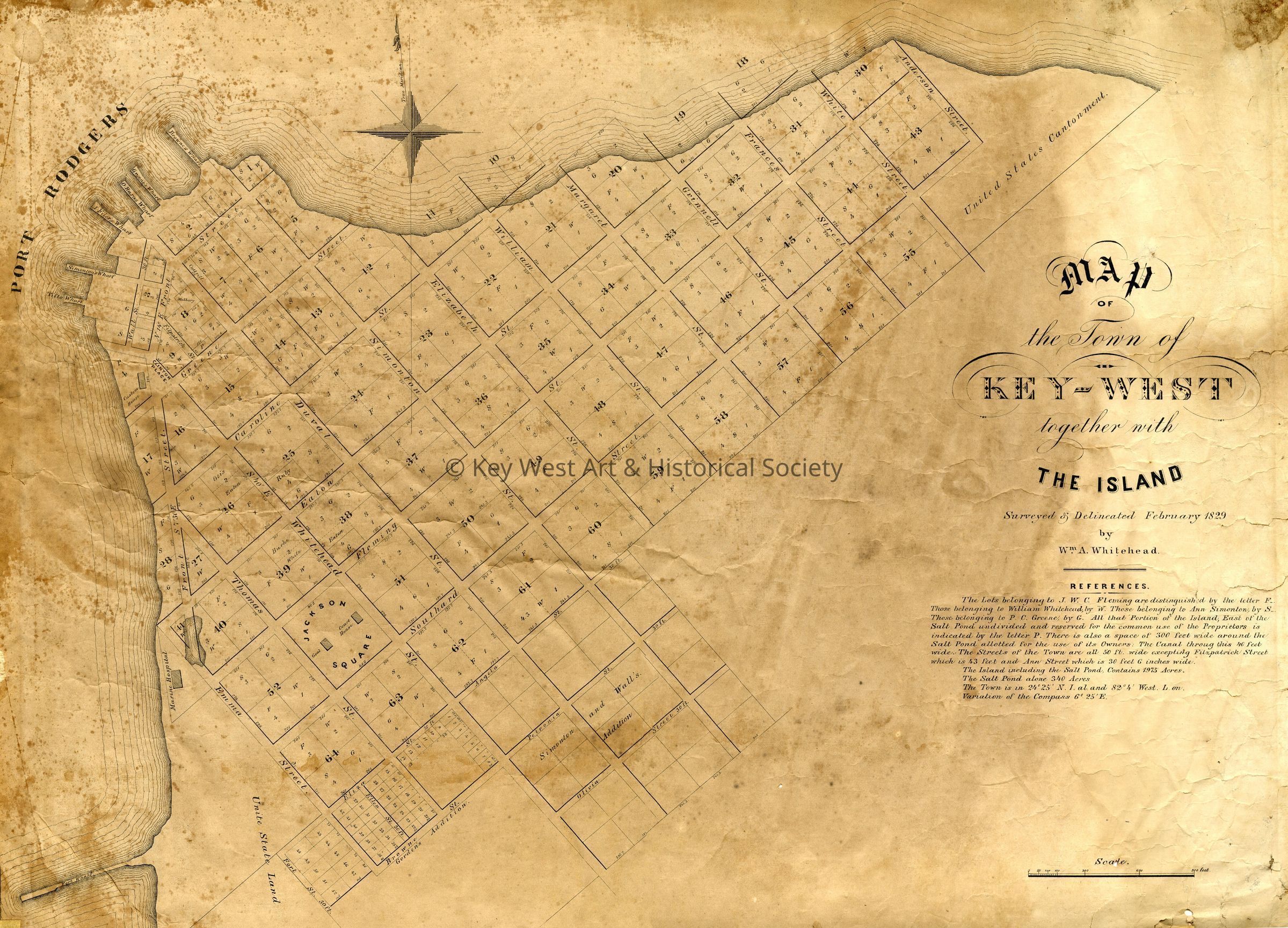
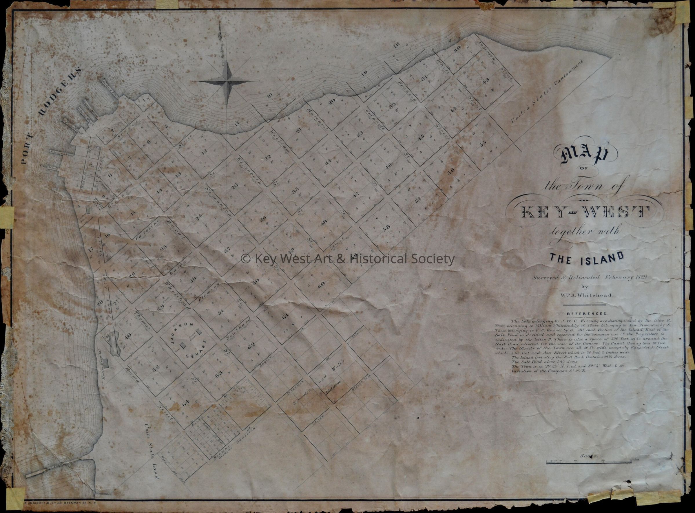
Map of the Town of Key West Together with the Island
Name/Title
Map of the Town of Key West Together with the Island
Entry/Object ID
2017.08.0001
Description
Print map of the town of Key West surveyed and delineated by William Whitehead. The map lays out most of the streets in Old Town and the wharves along Port Rodgers.