Name/Title
Key West and its Defense PositionsEntry/Object ID
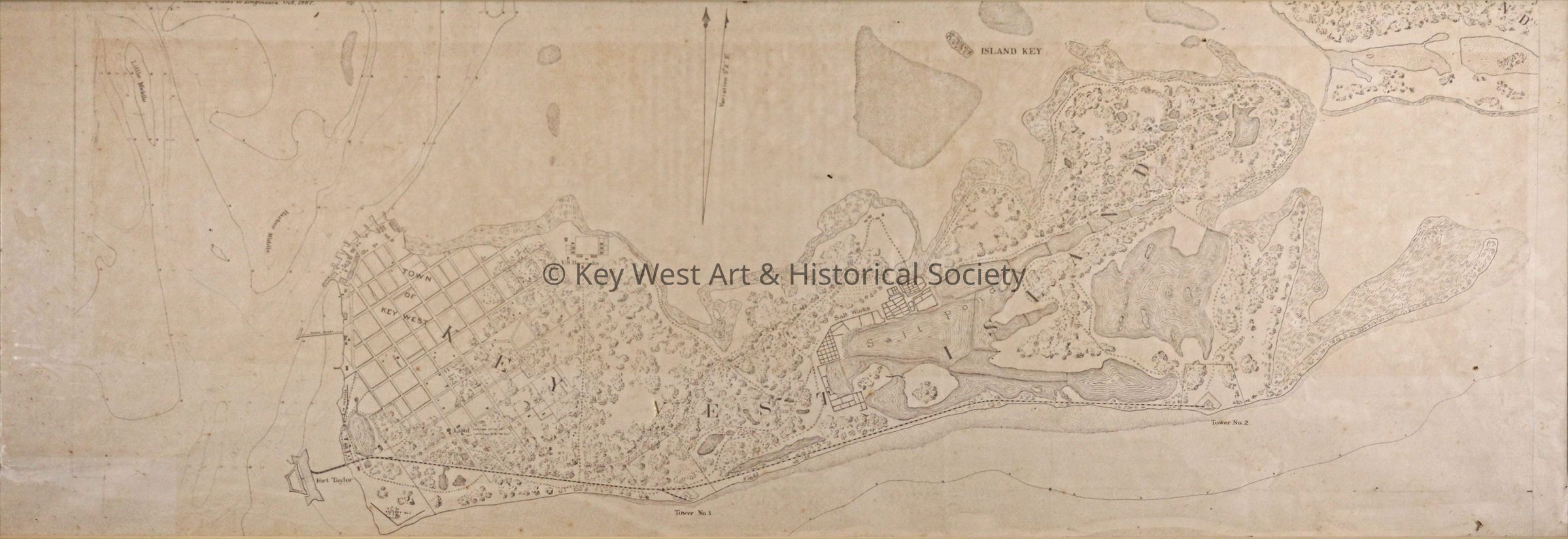
1987.01.1797Description
Office of Chief of Engineers map of Key West depicting the entire island including all three forts, the railway that connects them, the Key West Lighthouse, US Barracks and the Salt Ponds.Collection
Maps and Charts CollectionLexicon
Nomenclature 4.0
Nomenclature Secondary Object Term
MapNomenclature Primary Object Term
CartographNomenclature Sub-Class
Graphic DocumentsNomenclature Class
Documentary ObjectsNomenclature Category
Category 08: Communication ObjectsMap Details
Date Published
October 1887Publication Language
English