HUB
Collections
Classifications
About
App
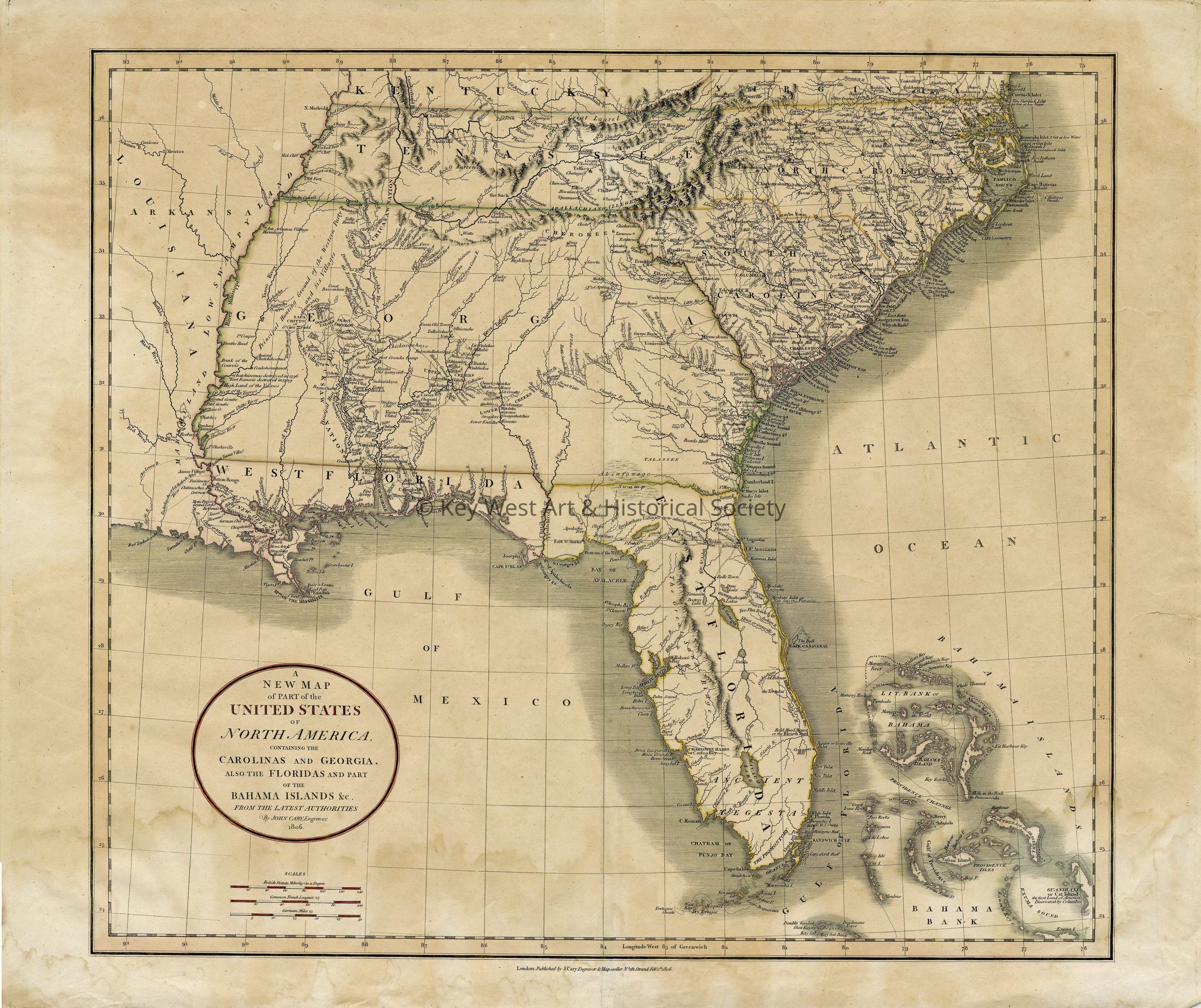
Map of the Carolinas, Georgia, Florida and the Bahama Islands
Print
-
Key West Art & Historical Society
Map of the Carolinas, Georgia, Florida and the Bahama Islands
© Key West Art & Historical Society
Name/Title
Map of the Carolinas, Georgia, Florida and the Bahama Islands
Entry/Object ID
1987.01.1188
Description
Hand tinted lithograph depicting the Carolinas, Georgia, Florida and the Bahamas prior to Key West settlement.
Type of Print
Lithograph
Artwork Details
Medium
Paper,
Ink
Subject Place
State/Province
Florida
Country
United States of America
Continent
North America
Collection
Archive Collection
Made/Created
Artist
Carey, John
Date made
February 1, 1806 - circa 1835
Time Period
19th Century
Place
City
London
Region
United Kingdom,
Western Europe
Continent
Europe
Lexicon
Nomenclature 4.0
Nomenclature Tertiary Object Term
Lithograph
Nomenclature Secondary Object Term
Print, Planographic
Nomenclature Primary Object Term
Print
Nomenclature Sub-Class
Graphic Documents
Nomenclature Class
Documentary Objects
Nomenclature Category
Category 08: Communication Objects
Dimensions
Height
22 in
Width
24 in
Condition
Reason for Exam
Inventory
Overall Condition
Good