Whaltonville Plat Map

Whaltonville Plat Map Lot #2 Section 19 To 67 Range 26 E: © Key West Art & Historical Society
Whaltonville Plat Map Lot #2 Section 19 To 67 Range 26 E

© Key West Art & Historical Society

Name/Title

Whaltonville Plat Map

Entry/Object ID

2022.09.0004

Scope and Content

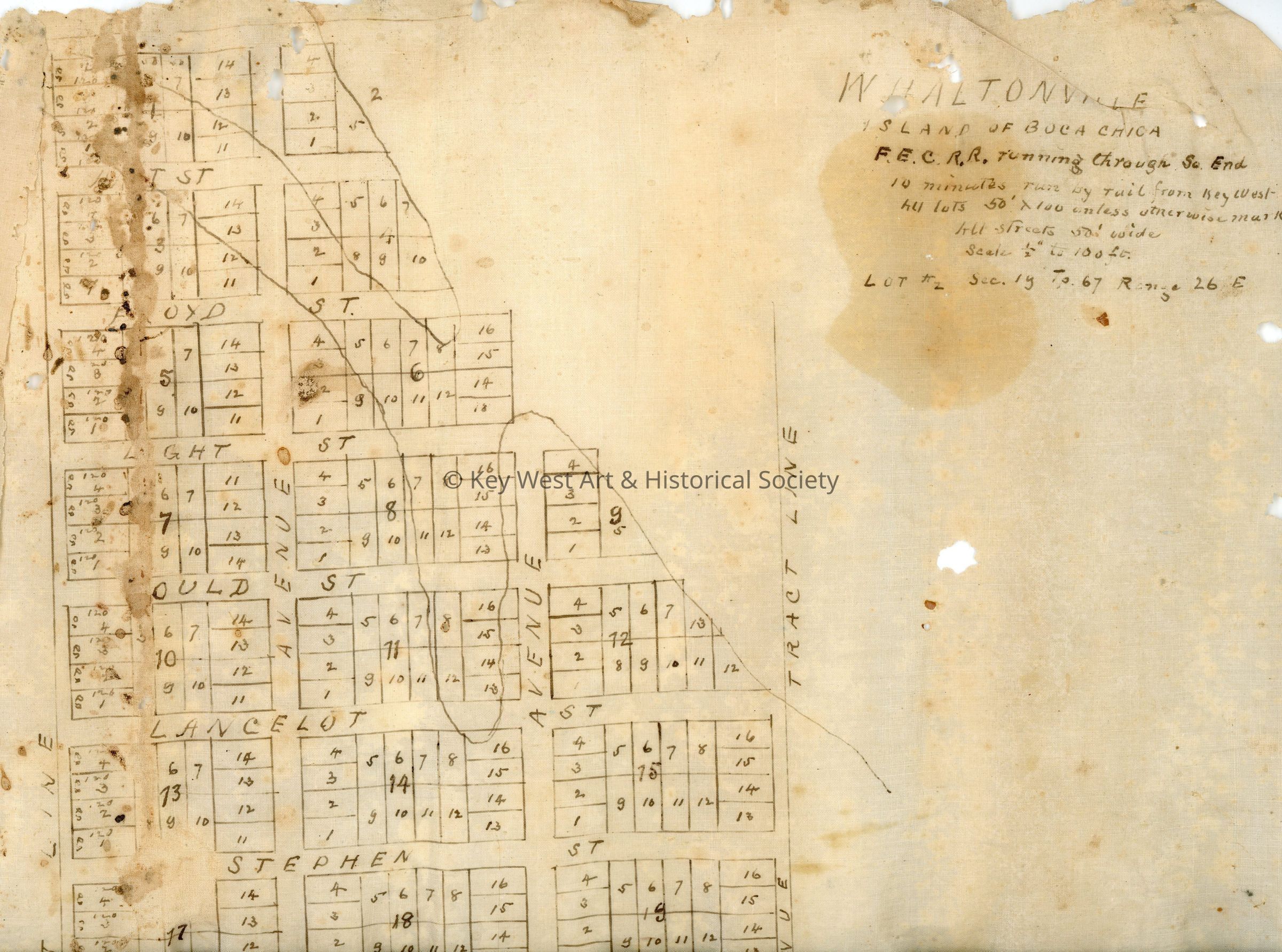
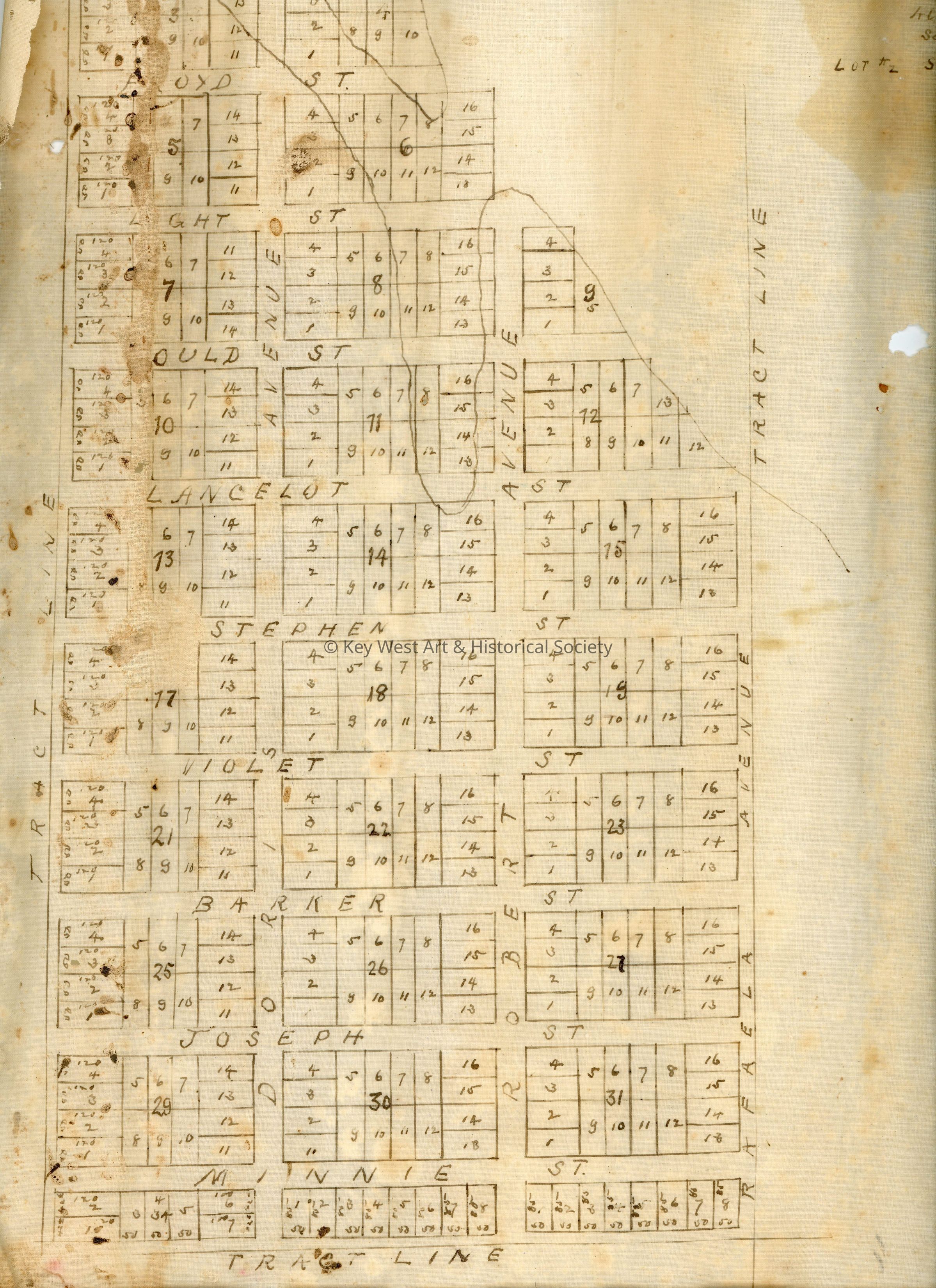
A plat map for the proposed development of Whaltonville on Boca Chica Key. This map was drawn on thin, stiff canvas. The top right corner reads 'Whaltonville / Island of Boca Chica / F.E.C.R.R. running through So. End / 10 minutes run by rail from Key West / All lots 50' X 100 unless otherwise marked / All streets 50' wide / Scale 1/2" to 100 ft. / Lot #2 Sec. 19 To 67 Range 26 E.' The development of Whaltonville never occurred.

Collection

Archive Collection

Lexicon

Nomenclature 4.0

Nomenclature Tertiary Object Term

Plat

Nomenclature Secondary Object Term

Map

Nomenclature Primary Object Term

Cartograph

Nomenclature Sub-Class

Graphic Documents

Nomenclature Class

Documentary Objects

Nomenclature Category

Category 08: Communication Objects

Archive Details

Date(s) of Creation

circa 1910 - circa 1935

Archive Size/Extent

1 Plat Map

Restrictions

No Restrictions

Primary Language

English

Dimensions

Height

15-1/2 in

Width

11-1/2 in

Parts

Count

1

Condition

Reason for Exam

Inventory

Overall Condition

Fair