Name/Title
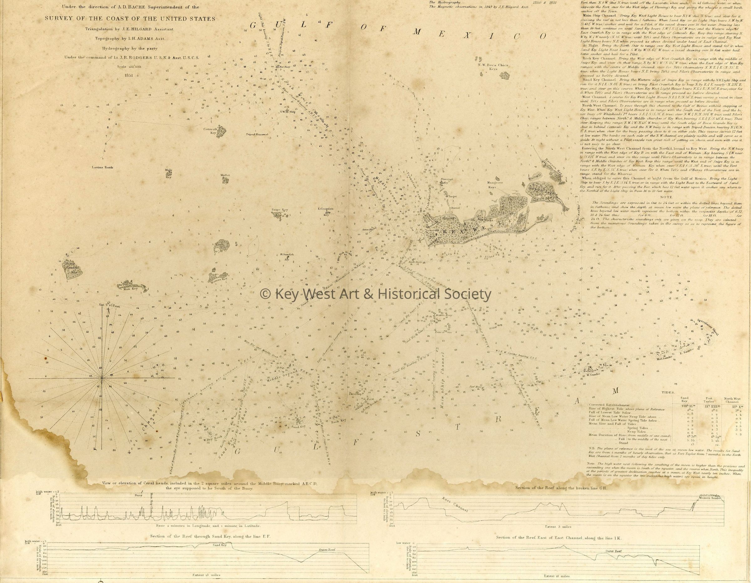
Preliminary Chart of Key West Harbor and ApproachesEntry/Object ID
1987.01.1463Description
This map was compiled under the supervision of A. D. Bache, with triangulation conducted by J. H. Hilgard in 1849, topographic work by I. H. Adams in 1850–1851, and hydrographic surveys carried out by a U.S. Navy team under Lieutenant John Rodgers in 1850–1851. The engraved reduction was prepared by E. K. Knorr, with outlines and topography by A. Rollé and lettering by Edw. Yeager.
Centered on Key West, the map covers the area from Boca Grande Key eastward to Raccoon Key, north to the N.W. Boca Chica Keys, and south to West Dray Rock and Sand Key. It depicts extensive depth soundings and isolines, channels, shoals, beacons, including a tripod beacon, buoys, and prominent landmarks such as Fort Taylor, the salt works, and the Key West Lighthouse. The map is accompanied by four bathymetric and elevation diagrams, a tide table, and detailed sailing directions intended to assist navigators. It was designated “Sketch F No. 5” in the Superintendent’s Annual Report for 1851.Collection
Maps and Charts CollectionLexicon
Nomenclature 4.0
Nomenclature Secondary Object Term
Chart, NavigationalNomenclature Primary Object Term
ChartNomenclature Sub-Class
Graphic DocumentsNomenclature Class
Documentary ObjectsNomenclature Category
Category 08: Communication ObjectsMap Details
Scale
1: 100,000Area or Region
City
Key WestState/Province
FloridaCountry
United States of AmericaContinent
North AmericaCounty
MonroeDate Published
1851Publication Language
English