Name/Title
MapEntry/Object ID
T2004.102Description
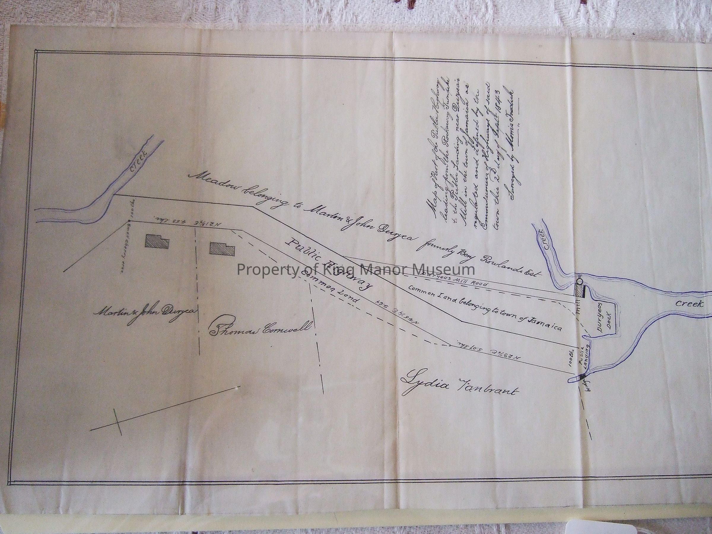
"Map of part of the Public Highway/leading from the Rockaway Turnpike to the Public Landing near Duryear's Mill in the town of Jamaica as regulated and defined by the commissioners of Highways of said town this 2d day of Sept. 1843/Surveyed by Morris Fosdick" On vellum or waxed linen?Collection
King Manor MuseumMade/Created
Date made
1843Notes
Early Date: 1843Dimensions
Height
15-3/8 inWidth
9-1/2 in