Name/Title
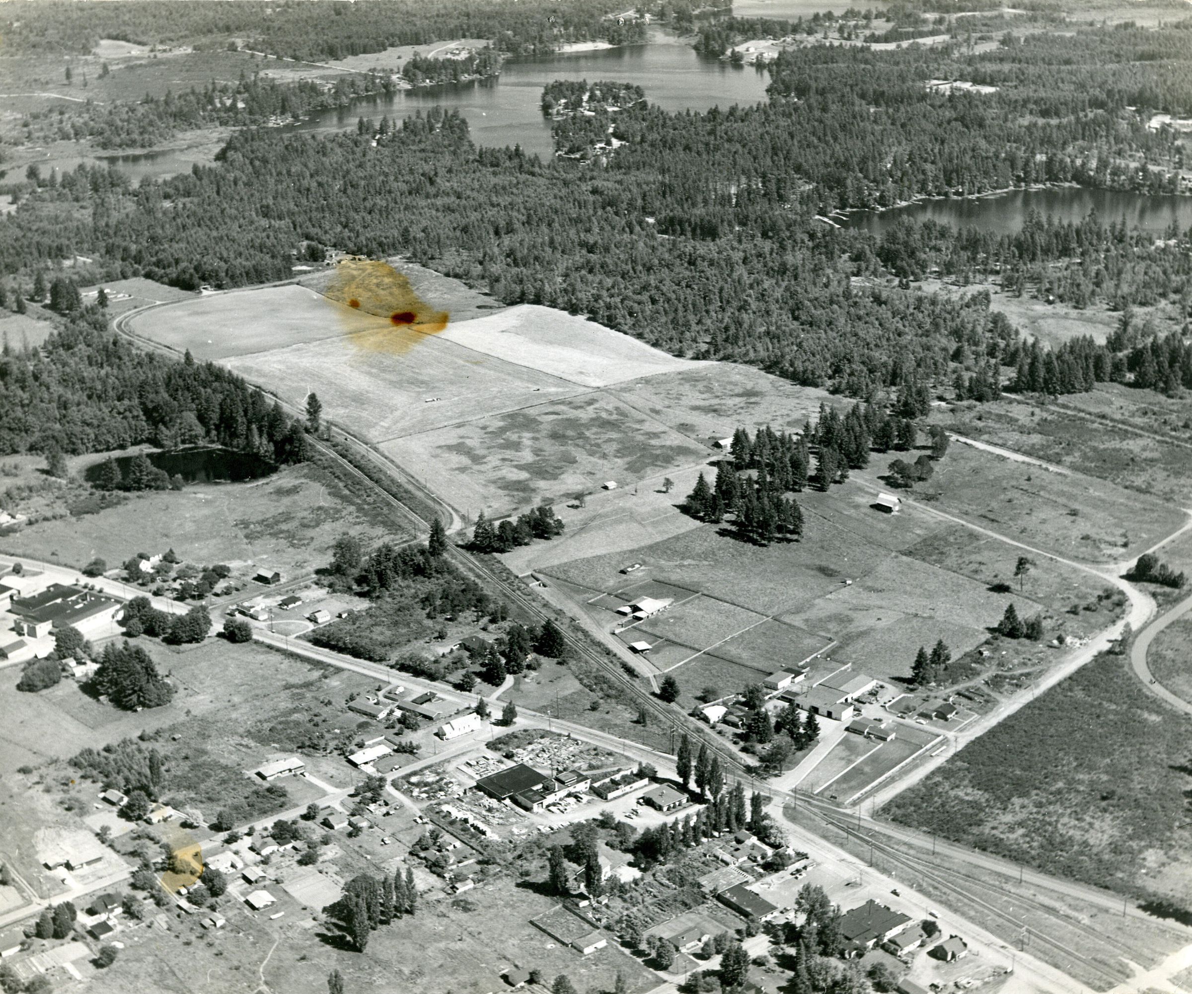
Aerial of Carpenter Road looking southeast, c. 1960sEntry/Object ID
2010-013-0008Description
Black and white aerial photograph (scanned copy) of Carpenter Road, looking southeast over Lacey. As of 2021, the is where the North Thurston Public School Bus Barn is located. The railroad runs diagonally through this image and Pacific Avenue along the bottom. At the top of the photo is Long Lake and Hicks Lake to the right. At the bottom is A. G. Homann Construction and the Fire Hall.Made/Created
Date made
circa 1960 - circa 1969Place
City
LaceyCounty
ThurstonState/Province
WashingtonCountry
United StatesContinent
North AmericaNotes
The 1960 map of Lacey shows Carpenter road still hugging the rail line. The 1970 Lacey map shows Carpenter when it is moved (open land in this photo). The Homann House and property is more developed in this image, which leads to the conclusion that it was taken c. 1960s.