Name/Title
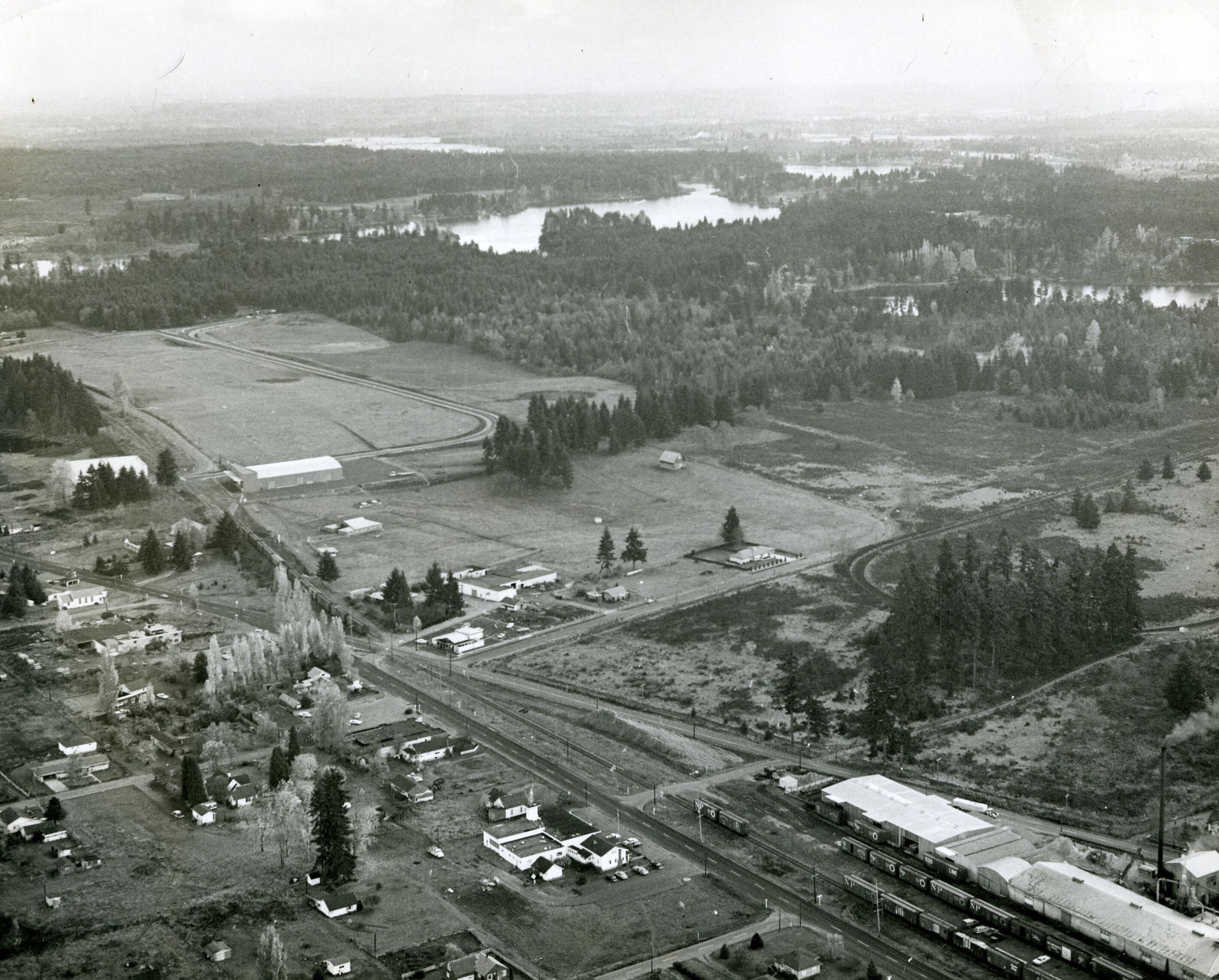
Aerial of Lacey looking southeast, c. 1969Entry/Object ID
2010-013-0009Description
Black and white aerial photograph (scanned copy) of Carpenter Road, Pacific Avenue and Lacey Boulevard, looking southeast over Lacey. At the bottom right is Lacey Plywood Company and at center right is the racetrack. Long Lake (left) and Hicks Lake (right) can be seen off in the distance. At center left is Carpenter Road. Bottom center is the Lacey Fire headquarters. The Russell House is the building attached with a covered walkway to the west.Made/Created
Date made
1968 - 1970Place
City
LaceyCounty
ThurstonState/Province
WashingtonCountry
United StatesContinent
North AmericaNotes
The 1960 map of Lacey shows Carpenter road still hugging the rail line. The 1970 Lacey map shows Carpenter with the curve as pictured and indicates the placement of the Homann Industrial Park (not yet built in this image). It's hard to be sure, but it appears as though the Russell House is being used as City Hall, which would further corroborate the date of c.1969.