Name/Title
Aerial of Carpenter Road, c. 1969Entry/Object ID
2010-013-0005Description
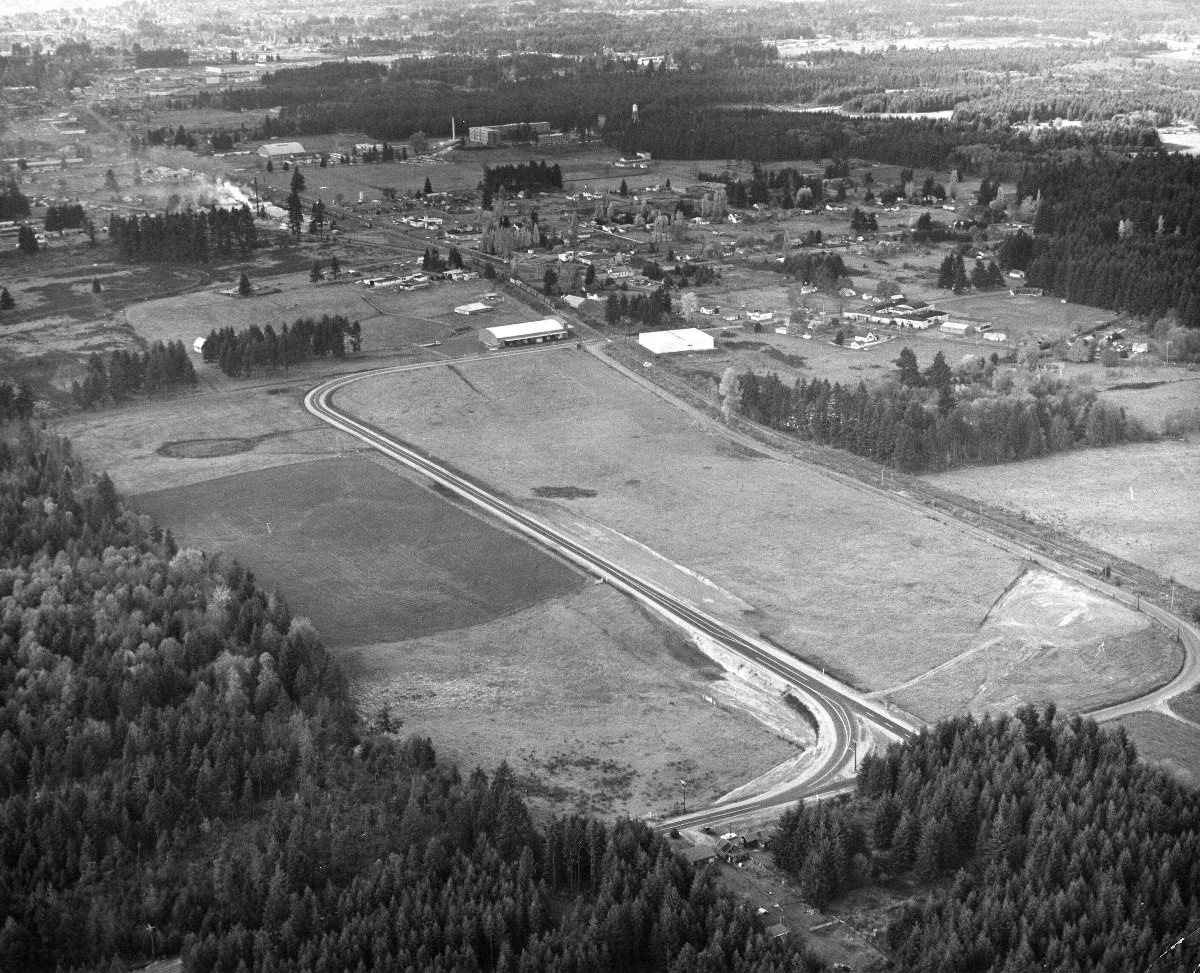
Black and white aerial photograph (scanned copy) of Carpenter Road, looking northwest over Lacey. As of 2021, the is where the North Thurston Public School Bus Barn is located. The railroad runs diagonally through this image with a train coming through from the west.Made/Created
Date made
1968 - 1970Place
City
LaceyCounty
ThurstonState/Province
WashingtonCountry
United StatesContinent
North AmericaNotes
The 1960 map of Lacey shows Carpenter road still hugging the rail line, and this image shows the newly built Capital Pavilion (opened Jan 1968). The 1970 Lacey map shows Carpenter with the curve as pictured and indicates the placement of the Homann Industrial Park (not yet built in this image).