Name/Title
Drawing, TechnicalEntry/Object ID
1991.143.0222Scope and Content
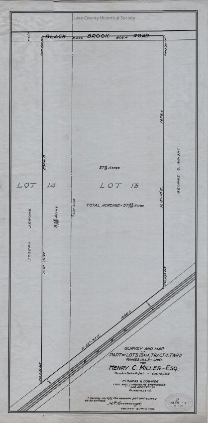
Survey and map of part of lots 13 and 14, tract 4, township 11, Painesville, Ohio for Henry C. Miller, Esq.
Made by Cumings and Downer. Used by City/County Engineers and Surveyors (Painesville/Lake).
Dimensions: Height 14" Length 27"Collection
Documentary ArtifactsLexicon
Nomenclature 4.0
Nomenclature Secondary Object Term
Drawing, TechnicalNomenclature Primary Object Term
ProjectionNomenclature Sub-Class
Graphic DocumentsNomenclature Class
Documentary ObjectsNomenclature Category
Category 08: Communication ObjectsArchive Details
Date(s) of Creation
Oct 15, 1912Archive Notes
Early Create Date: 1912Condition
Overall Condition
Excellent