Copyright: LJHA; Origsize: 8 x 10; Origformat: Print-Photographic; Resolution: 300
Name/Title
Print, Photographic
Entry/Object ID
2004.28.5
Description
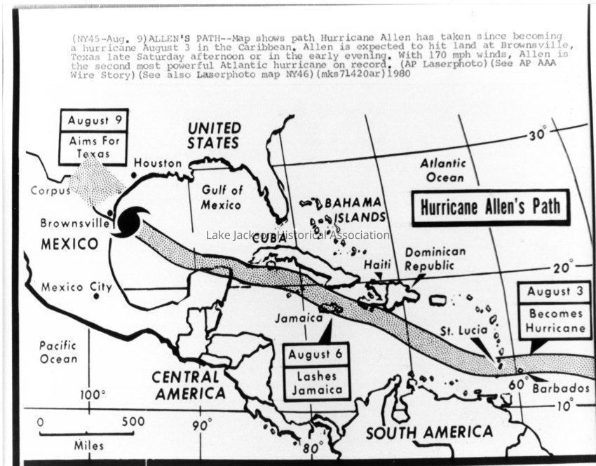
B/W Photo of a map during Hurricane Allen 1980. The map shows the path that Hurricane Allen had taken since becoming a hurricane on August 3 in the Caribbean. With 170 mph winds, Allen is the second most powerful hurricane on record.