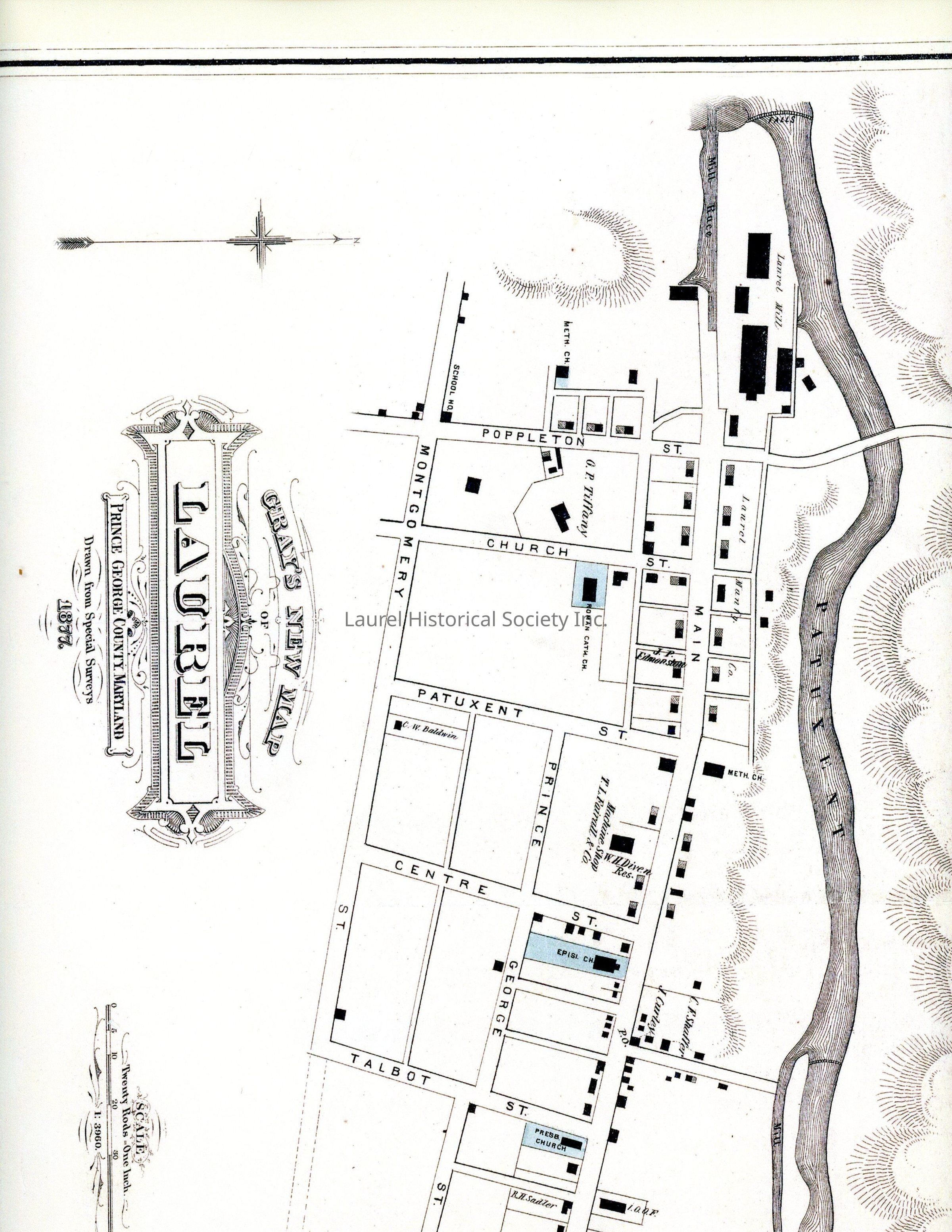
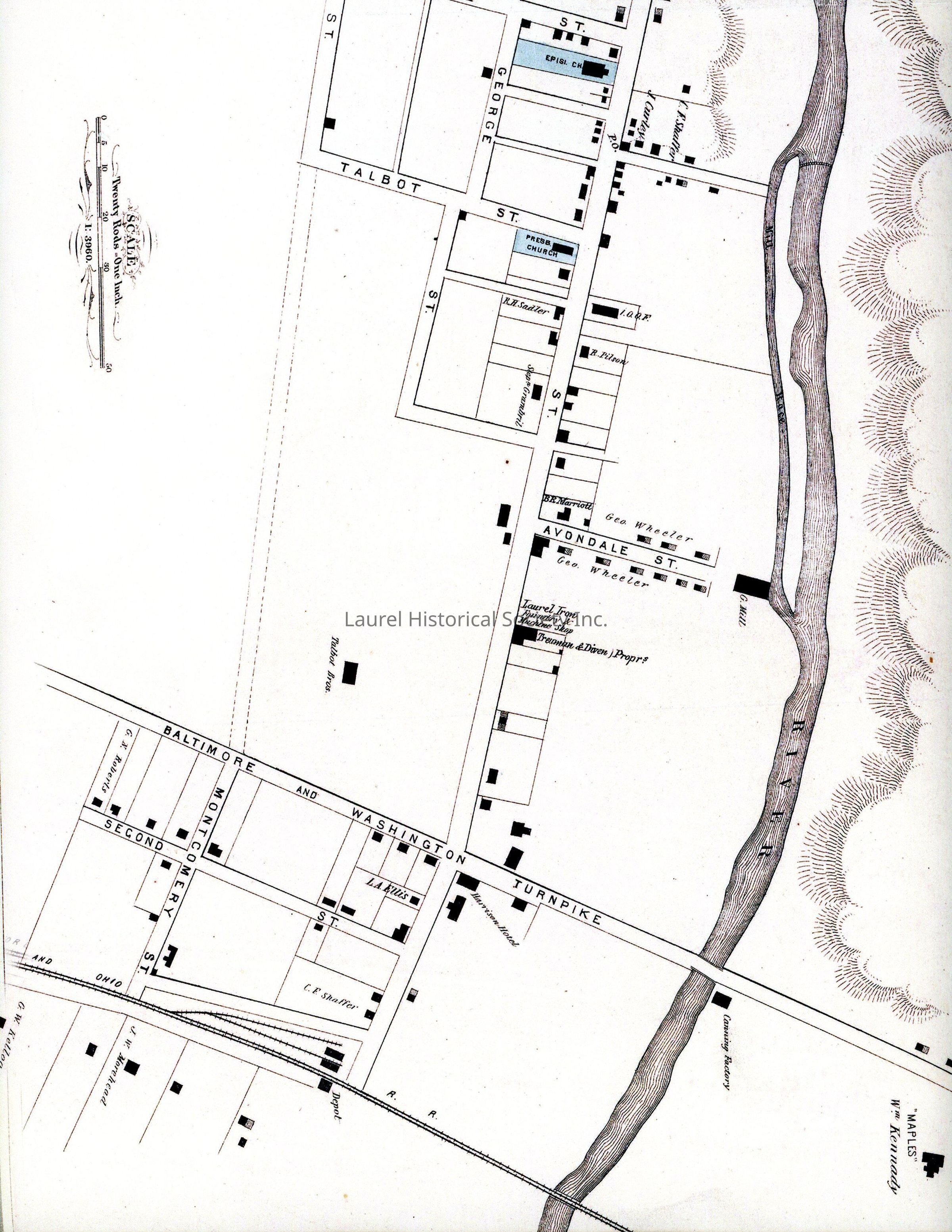
This is not an original but an online ordered copy of an 1877 Map of Laurel, MD. This map is interesting because it has significant differences from the 1878 map the LHS has and which has been a key reference. For example, The Talbott property is not subdivided, some streets have different names, the Railroad seems to show three additional tracks at the depot.
Lexicon
Nomenclature 4.0
Nomenclature Secondary Object Term
Map
Nomenclature Primary Object Term
Cartograph
Nomenclature Sub-Class
Graphic Documents
Nomenclature Class
Documentary Objects
Nomenclature Category
Category 08: Communication Objects
Search Terms
Talbott, Laurel Cotton Mill, Main Street, Presbyterian Church, Prince George's County