Name/Title
Print, PhotographEntry/Object ID
P9445Description
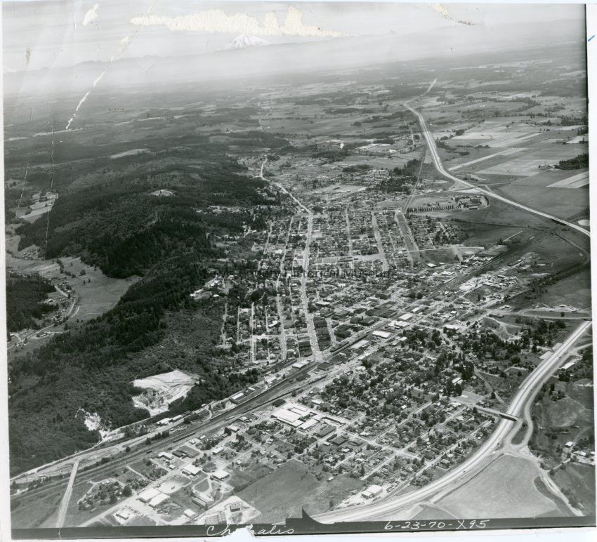
Aerial photo of Chehalis, WA, circa 1970. Overpass at the left corner is the National Aveneu Freeway exit. To the right is the diggings of the Brick and Tile Co., which appears across highway and the RR spur, Kostick Bros. Scrap Metal and Welding is between the diggins and National Ave., Market Street runs mid bottom to top pointing toward Mt. St. Helens. Through right corner is I-5. To left center is Coal Creek.Collection
Chehalis, WALexicon
Nomenclature 4.0
Nomenclature Secondary Object Term
Print, PhotographicNomenclature Primary Object Term
PhotographNomenclature Sub-Class
Graphic DocumentsNomenclature Class
Documentary ObjectsNomenclature Category
Category 08: Communication ObjectsSearch Terms
Chehalis, WACreate Date
February 2, 2016Update Date
February 28, 2024