Name/Title
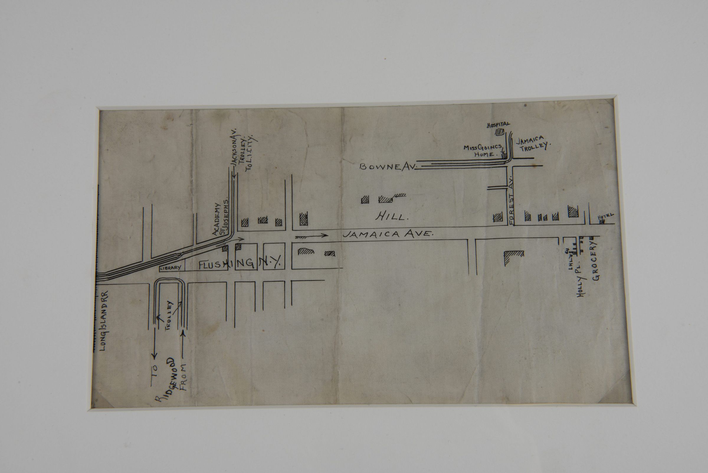
Hand-Drawn Map of Flushing, New YorkDescription
This is a hand-drawn map depicting a section of Flushing, New York, with key roads, landmarks, and transportation routes. It includes Jamaica Avenue, Bowne Avenue, and Flushing, NY, as well as various trolley lines and the Long Island Railroad. Several locations are labeled, including a library, grocery store, hospital, and Mischaud's Home. The map provides directional markers for areas leading to Richmond and other surrounding locations.Context
Hand-drawn maps like this one were often created for personal navigation, urban planning, or documentation of significant locations. This map may have been drawn by Lewis H. Latimer or someone within his circle, possibly outlining locations relevant to his home and community in Flushing, Queens. During the late 19th and early 20th centuries, Flushing was undergoing development, and trolley systems played a key role in transportation.Collection
Latimer Family Papers (1870-1996 ) [QPL Full Collection]Inscription/Signature/Marks
Transcription
Jamaica Ave.
Flushing, N.Y.
Long Island R.R.
Library
Bowne Ave.
Hill
Mischaud’s Home
Hospital
Jamaica Trolley
Holly Plan Grocery
Academy & Trolley to City
Steary
Trolley to Richmond From