Name/Title
Map of Earl TownshipEntry/Object ID
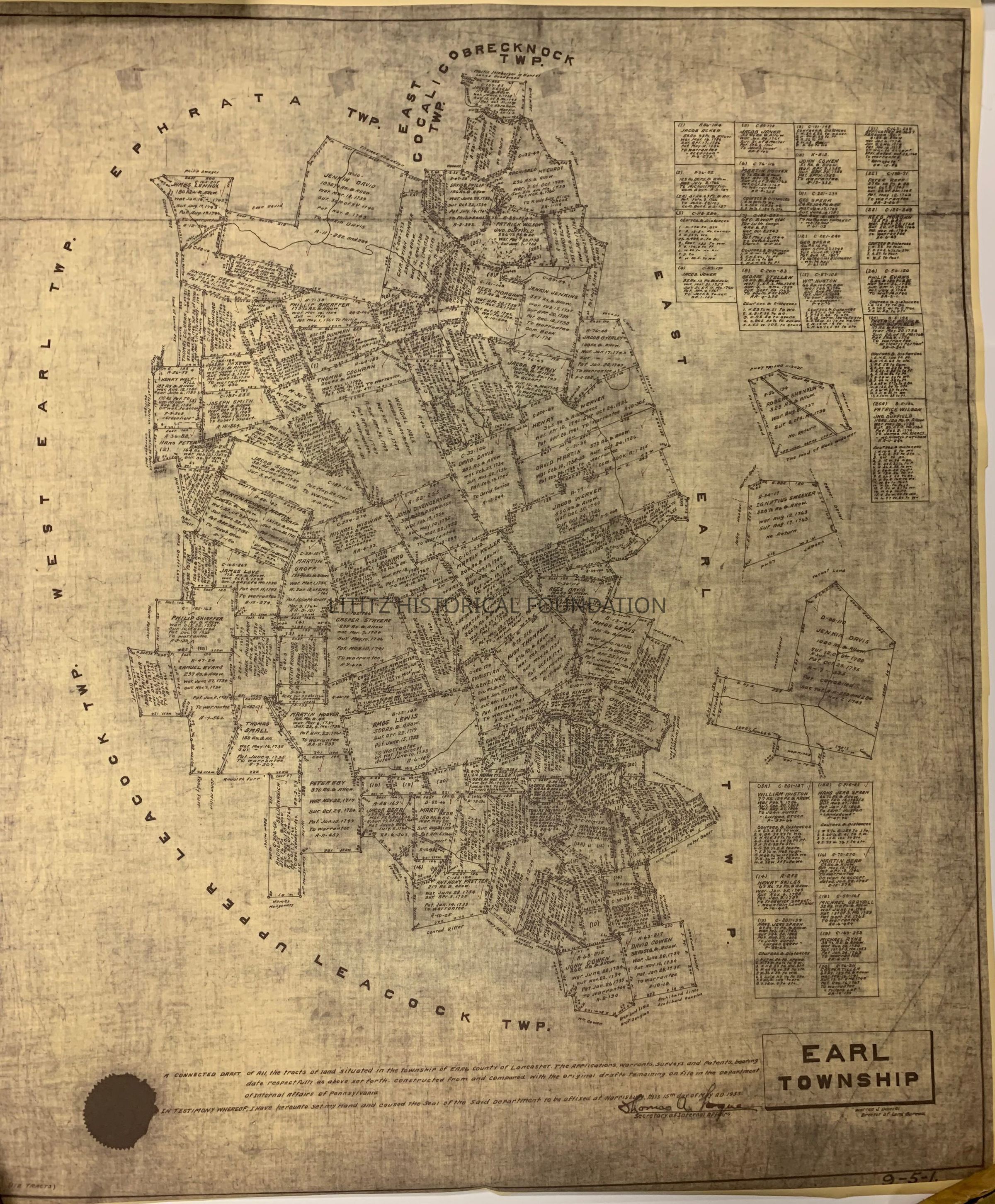
2023.17.11Description
Shows the location of land 112 tracts with the dates of survey, patent filing, and recording.Collection
Gary T. Hawbaker CollectionMap Details
Maker or Creator
Pennsylvania Department of Internal AffairsScale
100 rods per inchArea or Region
Township
Earl TownshipCounty
Lancaster CountyState
PennsylvaniaCountry
United StatesContinent
North AmericaPlace Published
City
HarrisburgState
PennsylvaniaCountry
United StatesContinent
North AmericaDate Published
May 15, 1935Time Period
20th CenturyPlace Printed
City
HarrisburgState
PennsylvaniaCountry
United StatesContinent
North AmericaPublication Language
EnglishMap Notes
Map shows warrants, surveys and patents for 112 tracts of land.Dimensions
Height
38-3/4 inWidth
32-1/2 inCreate Date
December 6, 2023Update Date
March 19, 2024