Name/Title
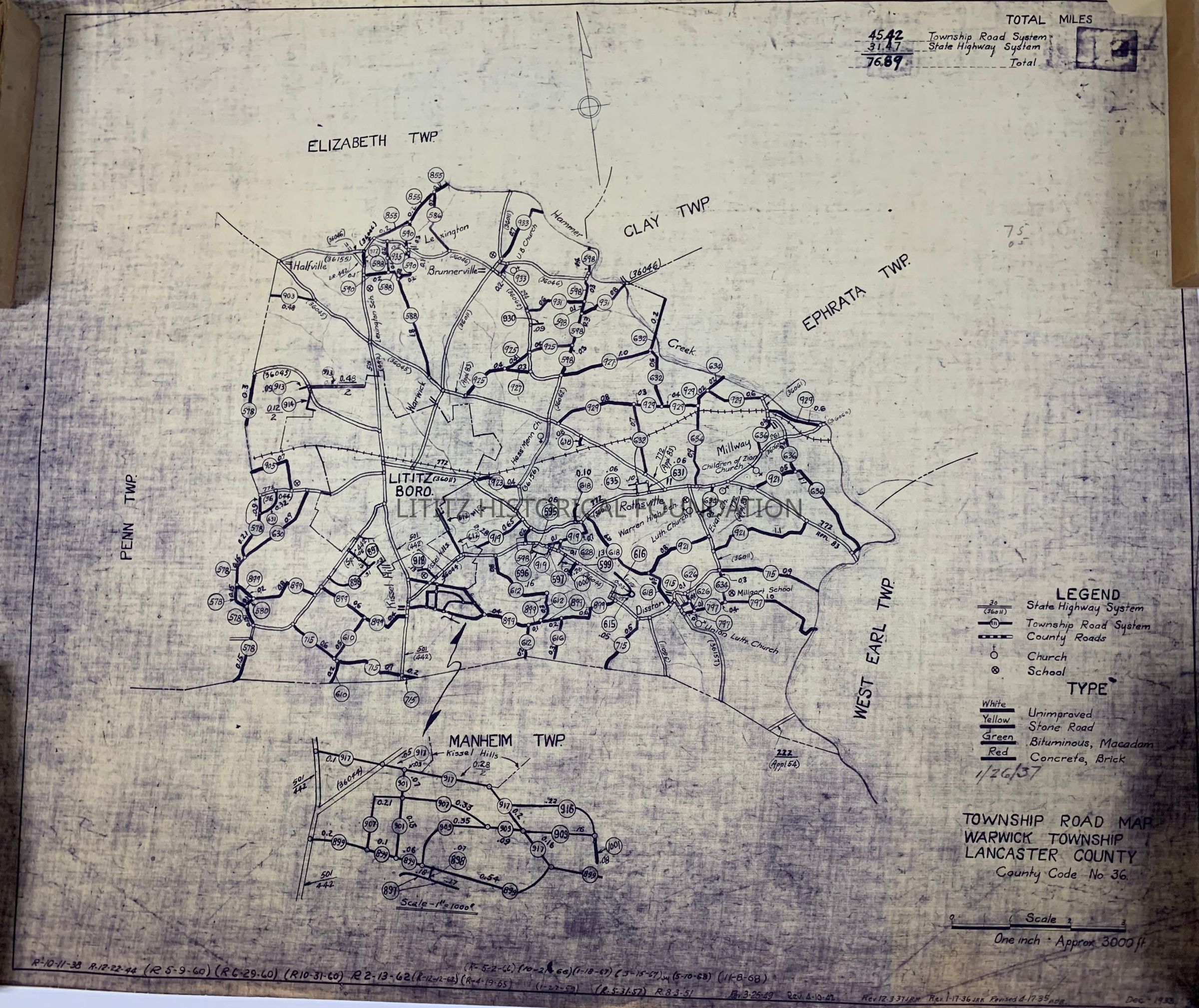
Road Map of Lititz BoroEntry/Object ID
2023.17.7Description
Shows state, township, and county roads. The original map was prepared in 1933. This printing includes revisions made through 1968.Collection
Gary T. Hawbaker CollectionMap Details
Maker or Creator
Pennsylvania Department of Internal AffairsScale
1 inch equals 3000 feetArea or Region
City
LititzState
PennsylvaniaCountry
United StatesContinent
North AmericaPlace Published
City
HarrisburgState
PennsylvaniaCountry
United StatesContinent
North AmericaDate Published
circa 1968Time Period
20th CenturyPlace Printed
City
HarrisburgState
PennsylvaniaCountry
United StatesContinent
North AmericaPublication Language
EnglishMap Notes
Highway system for Lititz BoroughDimensions
Height
18-1/8 inWidth
21-7/8 inCreate Date
December 6, 2023Update Date
March 19, 2024