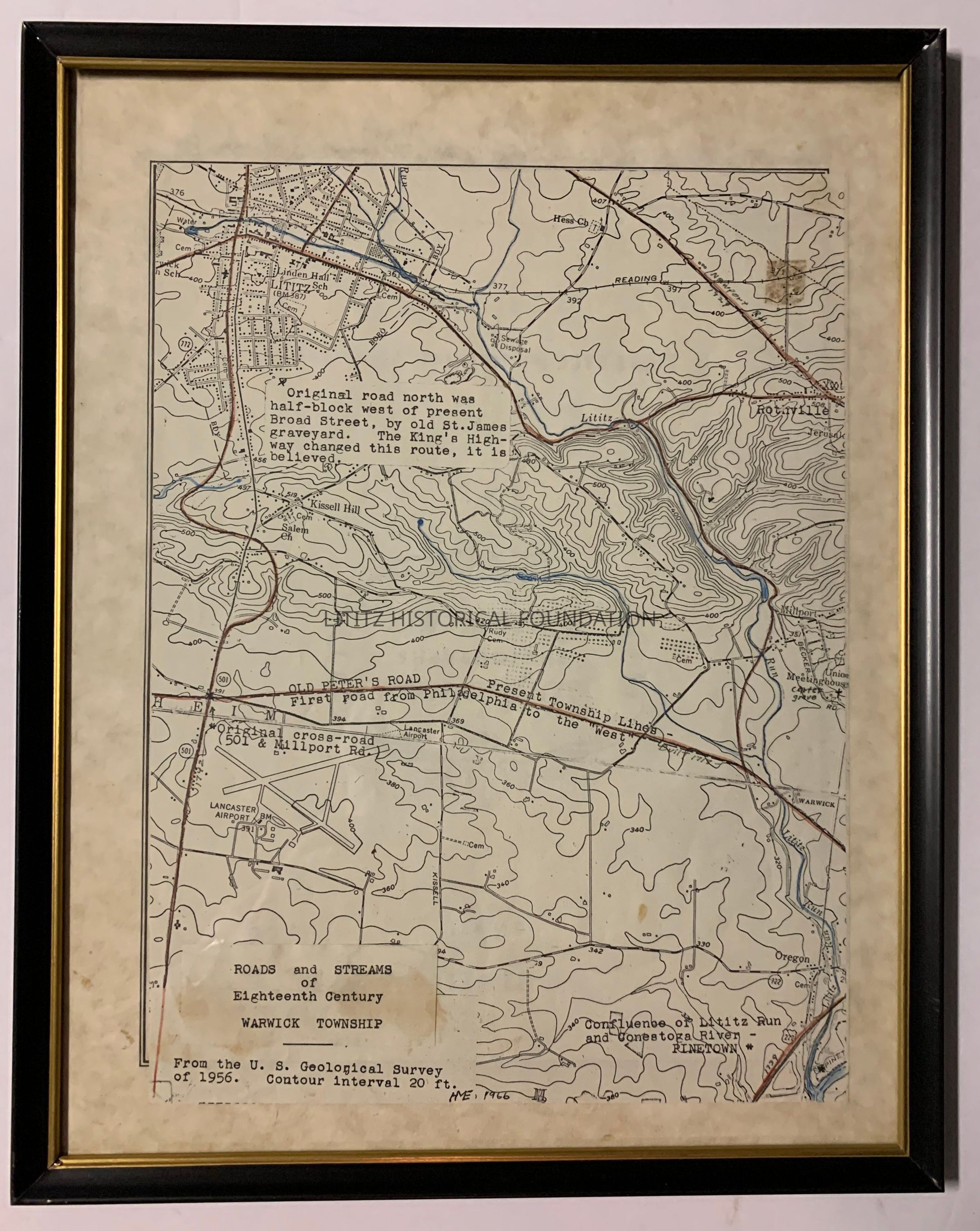
Name/Title
Roads and Streams of Eighteenth Century Warwick TownshipEntry/Object ID
1966.2.1Description
Map drawn by Hiram Eberly based on the U.S. Geological Survey of 1956.Map Details
Maker or Creator
Hiram M. EberlyScale
Contour interval 20 feetArea or Region
Township
Warwick TownshipCounty
Lancaster CountyState
PennsylvaniaCountry
United StatesContinent
North AmericaDate Published
1966Time Period
20th CenturyPlace Printed
City
LititzState
PennsylvaniaCountry
United StatesContinent
North AmericaDate Printed
1966Publication Language
EnglishCreate Date
March 19, 2024Update Date
June 20, 2024