Name/Title
America noviter delineataEntry/Object ID
L2024.4.32Description
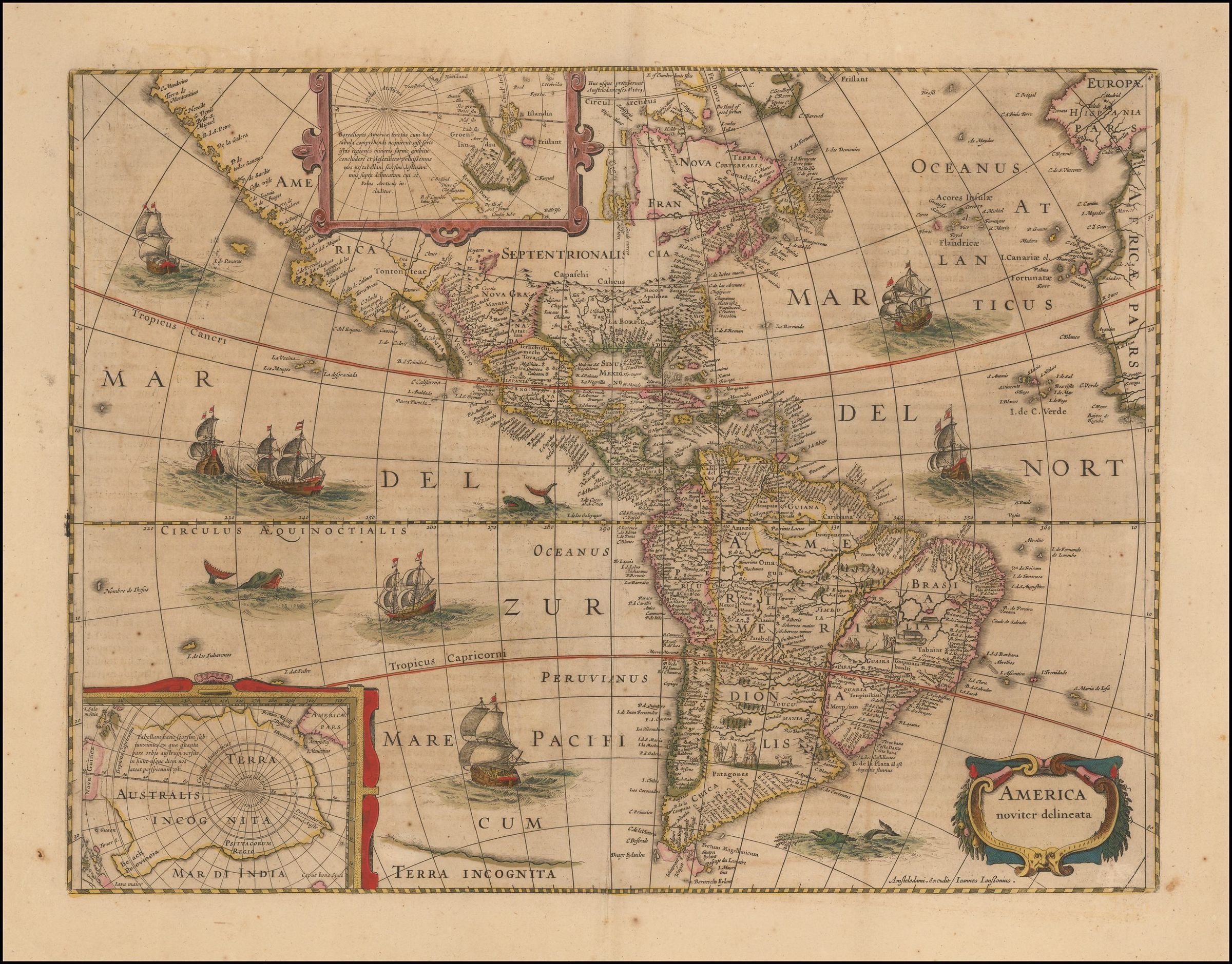
Old color example of the Hondius-Jansson Map of North America, first published in 1618.
The map includes a marvelous peninsular California with the Northwest Coast of America stretching almost due westward toward Asia, with over 30 place names. The Rio Grande flows into the Gulf of California and the 7 cities of Cibola are shown.
The map also displays an unusual East Coast of North America, packed full of place names, including Chesdpiooc (Chesapeake), Sanawanook, Hatoraske (Hatteras); Charlefort, Cap de S. Roman, etc. The Great Lakes are not yet shown, nor does Long Island appear.
The map depicts an oversized South America, with Indians and Animal vignettes in the interior. Includes Sailing Ships, Sea Monsters and other decorations.Collection
Barry Lawrence Ruderman Antique Maps CollectionLexicon
Search Terms
Antarctic; CartographyMap Details
Maker or Creator
Hondius, JodocusArea or Region
* Untyped Area or Region
North and South AmericaPlace Published
City
Amsterdam, NetherlandsCountry
NetherlandsRegion
Western EuropeContinent
EuropeDate Published
circa 1652