HUB
Collections
Classifications
About
App
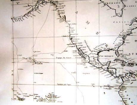
Early French Map Showing North America, Central America and the Pacific Ocean Between 70 and 180 Degrees Latitude
Photograph
-
Maritime Museum of San Diego
Name/Title
Early French Map Showing North America, Central America and the Pacific Ocean Between 70 and 180 Degrees Latitude
Entry/Object ID
P-03961
Photograph Details
Type of Photograph
Sepia
Collection
Photograph Collection
Made/Created
Date made
n.d.
Notes
Medium: Photo reproduction
Lexicon
Nomenclature 4.0
Nomenclature Secondary Object Term
Print, Photographic
Nomenclature Primary Object Term
Photograph
Nomenclature Sub-Class
Graphic Documents
Nomenclature Class
Documentary Objects
Nomenclature Category
Category 08: Communication Objects
Search Terms
Print, Photographic,
V-C Aids to Navigation