HUB
Collections
Classifications
About
App
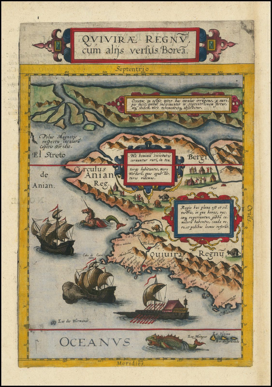
Quivirae Regnu cum alijs versus Borea
Map
-
Maritime Museum of San Diego
Name/Title
Quivirae Regnu cum alijs versus Borea
Entry/Object ID
L2024.4.26
Description
The Earliest Printed Map of the Northwest Coast of North America To Catalina and Southern California Fine old color example of this rare, important map depicting the west coast of North America, published by De Jode in 1593.
Collection
Barry Lawrence Ruderman Antique Maps Collection
Lexicon
Getty AAT
Concept
early maps
Legacy Lexicon
Object Name
Map
Map Details
Maker or Creator
Jode, Cornelis de
Area or Region
Region
Pacific Northwest
Continent
North America
Place Published
City
Antwerp, Belgium
Country
Belgium
Region
Western Europe
Continent
Europe
Date Published
1593
Web Links and URLs
https://www.raremaps.com/gallery/detail/99093