Title
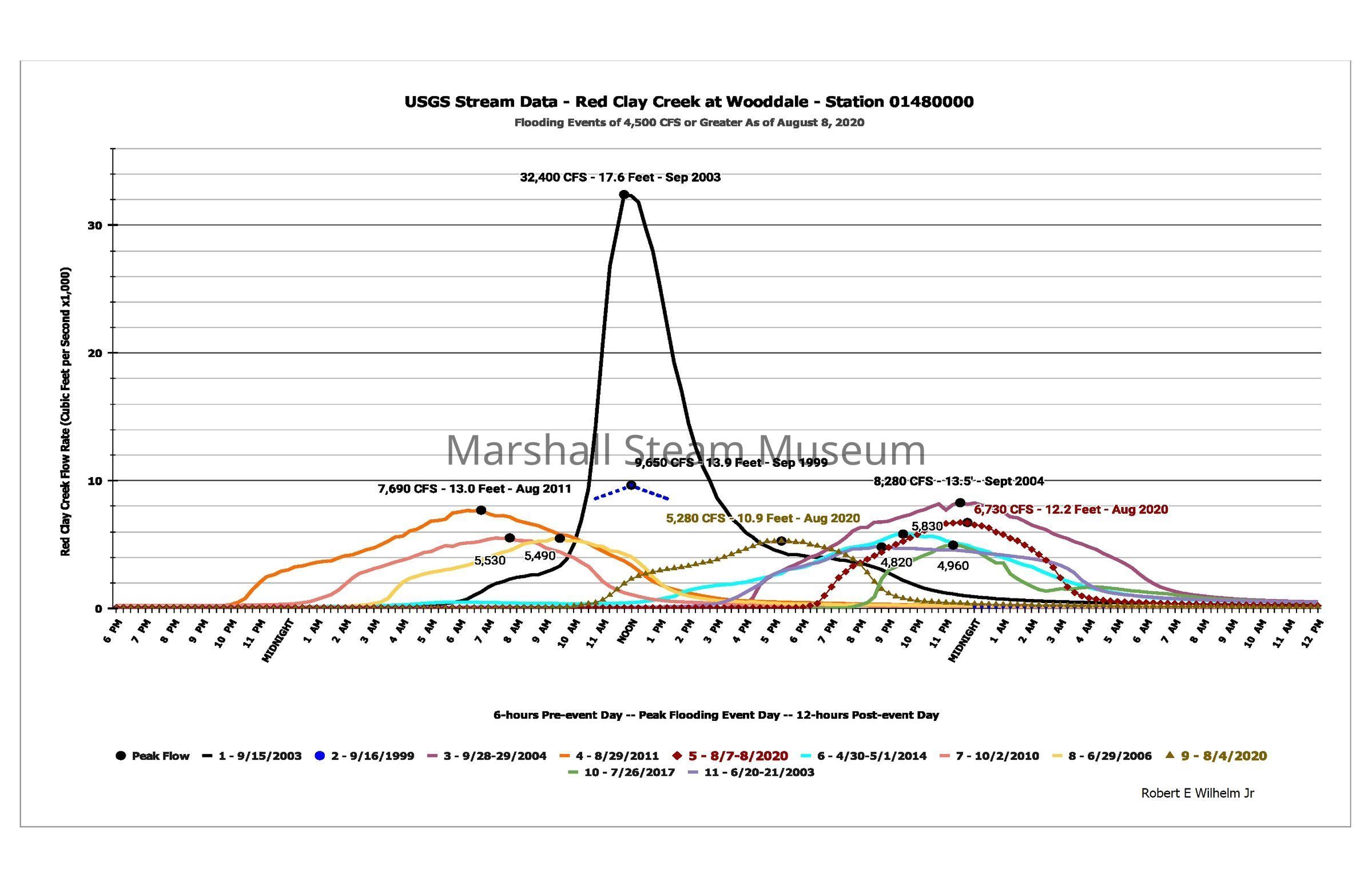
Historic Red Clay flood data, 1943-2020Description
This file contains historic stream data (gage height and streamflow) collected from the USGS Red Clay gage at Wooddale (near Route 48 and Hercules Road). The data was compiled and graphed courtesy of Robert Wilhelm, Jr.