Name/Title
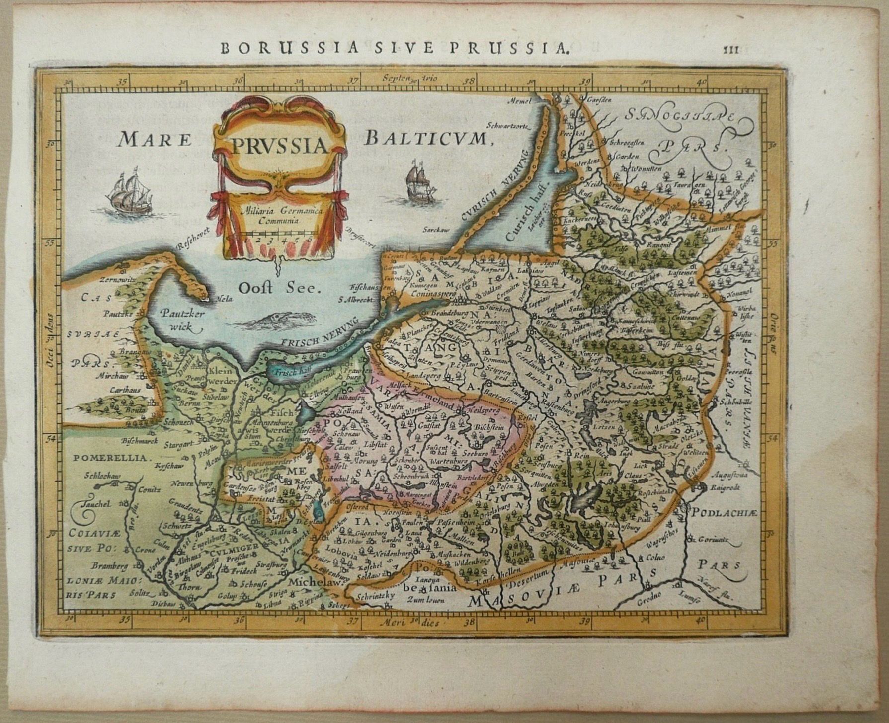
CE 1634 Johannes Janssonius, Borussia sive Prussia (Map of Prussia)Description
Johannes Janssonius (1588–1664)
Borussia sive Prussia
From the Atlas Minor tradition
Amsterdam, 1634
Copper engraving on paper with hand coloring
Approx. 18 × 22 cm
This small map depicts Prussia and the southeastern Baltic coast, extending across territories that today lie principally within Poland and the Russian Kaliningrad region. The Baltic Sea occupies the upper left, while rivers, settlements, political divisions, forests, and coastal features organize the interior landscape.
The map belongs to the compact atlas tradition developed for readers who wanted geographical information in a smaller and more portable format than the large folio atlases of the seventeenth century. Despite its size, it retains many conventions of larger Dutch maps, including graduated borders, dense place-name information, ships in the Baltic, and an ornamental title cartouche.
The title Borussia sive Prussia (“Borussia, or Prussia”) reflects the Latin geographical terminology of the period. The map predates the emergence of the later Kingdom of Prussia and depicts Prussia as a historical and geographical region within the politically fragmented Baltic world.
Janssonius was one of the major Amsterdam map publishers of the seventeenth century and a principal competitor of the Blaeu publishing house. His atlases contributed to Amsterdam’s position as an important European center for the production and circulation of geographical knowledge.Create Date
August 18, 2026Update Date
September 4, 2026