Name/Title
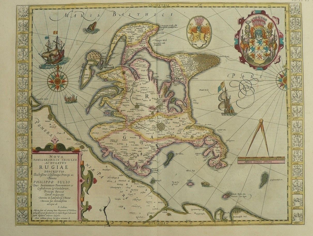
CE 1640–1641 c. Johannes Janssonius, Nova Famigerabilis Insulae ac Ducatus Rugiae Descriptio (Island of Rügen)Description
Johannes Janssonius (1588–1664)
After Philipp Julius
Amsterdam, c. 1640–1641
Copper engraving on paper with hand coloring
Approx. 47.5 × 49 cm
This map depicts Rügen, the largest island in present-day Germany, situated in the Baltic Sea off the Pomeranian coast. The island is represented in considerable topographical detail, with settlements, forests, waterways, roads, and coastal features surrounded by the waters of the Baltic.
The map’s decorative apparatus includes sailing vessels, compass roses, heraldic devices, a scale, and an elaborate title cartouche. The ornamental border contains a sequence of coats of arms associated with local territories and communities, integrating political geography into the physical representation of the island.
Rügen occupied an important position in the southern Baltic and had long been connected to maritime commerce and the political history of Pomerania. At the time this map was published, the Thirty Years’ War was transforming political control throughout the region. The Peace of Westphalia in 1648 subsequently placed Rügen within Swedish Pomerania.
The map was published by Johannes Janssonius during the expansion of the Amsterdam atlas trade in the seventeenth century. Its combination of detailed regional geography with heraldry and maritime imagery is characteristic of large-format Dutch cartography of the period.Create Date
June 3, 2026Update Date
September 4, 2026