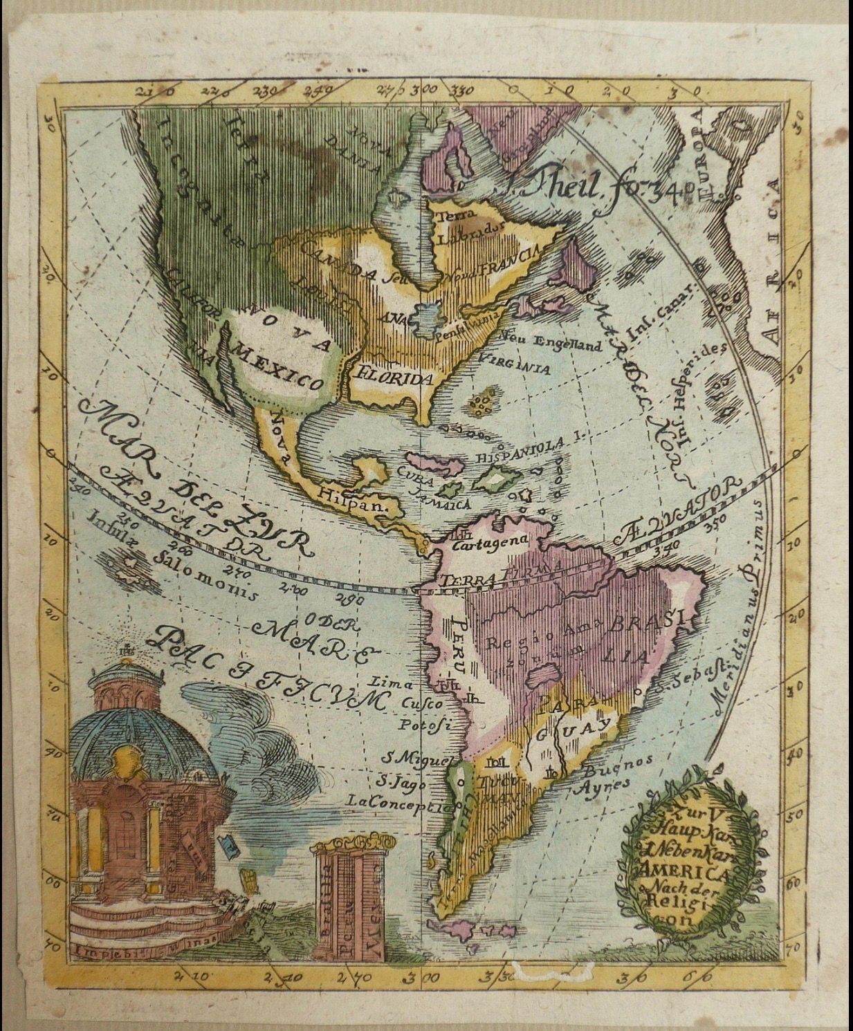
CE 1733 Anselm Desing, America nach den Religionen (Religious Map of the Americas) CE 1733 Anselmo Desing Religious map of Americas
Description
Anselm Desing (1699–1772)
America nach den Religionen
1733
Engraved map on paper with hand coloring
This map represents North and South America through a combination of conventional geography and religious classification. Its German title, America nach den Religionen, identifies its organizing principle: America “according to religions.” Colored and hatched territories distinguish regions according to the religious categories assigned to them by the mapmaker.
The map belongs to a form of eighteenth-century thematic cartography in which maps were used to organize information beyond physical and political geography. Religious affiliation is transformed here into spatial information, allowing a reader to interpret the Americas through categories imposed upon territories and populations.
That classificatory scheme also reflects a specifically European Christian understanding of the Americas. Indigenous societies appear through categories constructed by European observers, while European colonial territories are associated with the confessional identities of imperial powers and missionary activity. The map therefore documents not simply the distribution of religions but the ways eighteenth-century European scholars conceptualized religious and colonial difference.
The decorative imagery at lower left reinforces this framework. Religious architecture and associated symbols accompany the geographical image, visually connecting cartography with the map’s confessional subject.
As a historical source, the map is useful precisely because its classifications are not neutral descriptions of the populations represented. They show how geography, colonial expansion, missionary activity, and European systems for classifying peoples and religions intersected in eighteenth-century cartography.