Name/Title
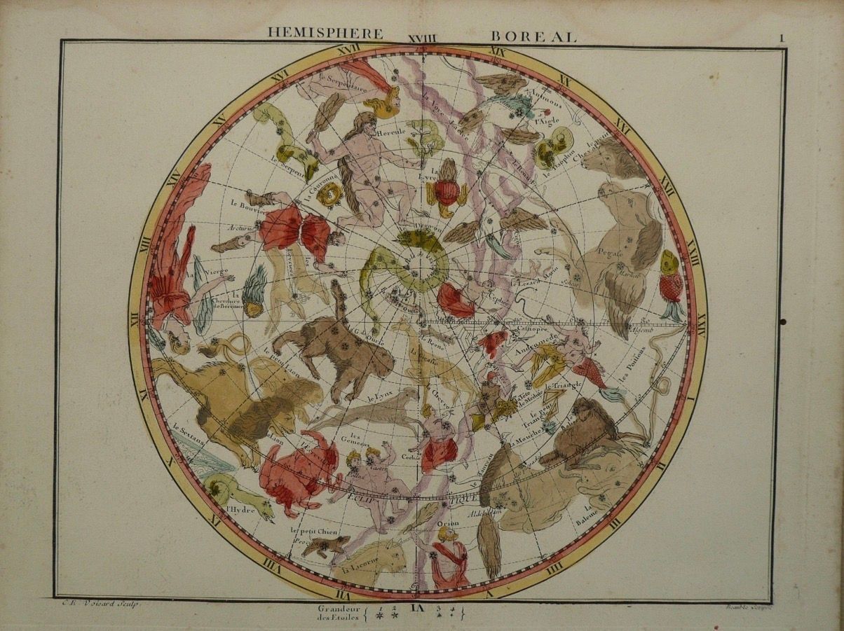
CE 1795 Jean-Baptiste Fortin, Hémisphère Boréal, after John FlamsteedDescription
John Flamsteed (1646–1719), astronomical data
Jean-Baptiste Fortin (1740–1817), editor/publisher
Hémisphère Boréal
From Atlas Céleste de Flamsteed, approuvé par l’Académie Royale des Sciences
Paris: Fortin, 1795
Copper engraving on paper with hand coloring
Approx. 18 × 23 cm
This celestial map depicts the northern sky as a circular hemisphere populated by constellations. Stars are plotted according to astronomical positions while traditional constellation figures—humans, animals, and mythological creatures—are superimposed upon them.
The map derives from the astronomical work of John Flamsteed, the first Astronomer Royal of England. Flamsteed’s observations provided exceptionally extensive positional data for stars, published posthumously in his Historia Coelestis Britannica and incorporated into the large Atlas Coelestis of 1729.
Later publishers adapted Flamsteed’s celestial atlas into more accessible formats. Jean-Baptiste Fortin produced French editions in which the astronomical information was retained while the scale and presentation were modified for a broader readership. This example comes from the Paris edition of 1795.
The image illustrates the coexistence of two systems of representing the heavens. Stellar positions belong to increasingly precise observational astronomy, while the constellation figures preserve much older Greek, Roman, and later European mythological traditions. Figures such as bears, heroes, serpents, and other creatures therefore function as visual frameworks imposed upon measured stellar coordinates.Create Date
June 11, 2026Update Date
September 4, 2026