Name/Title
MapEntry/Object ID
0110.1.31Description
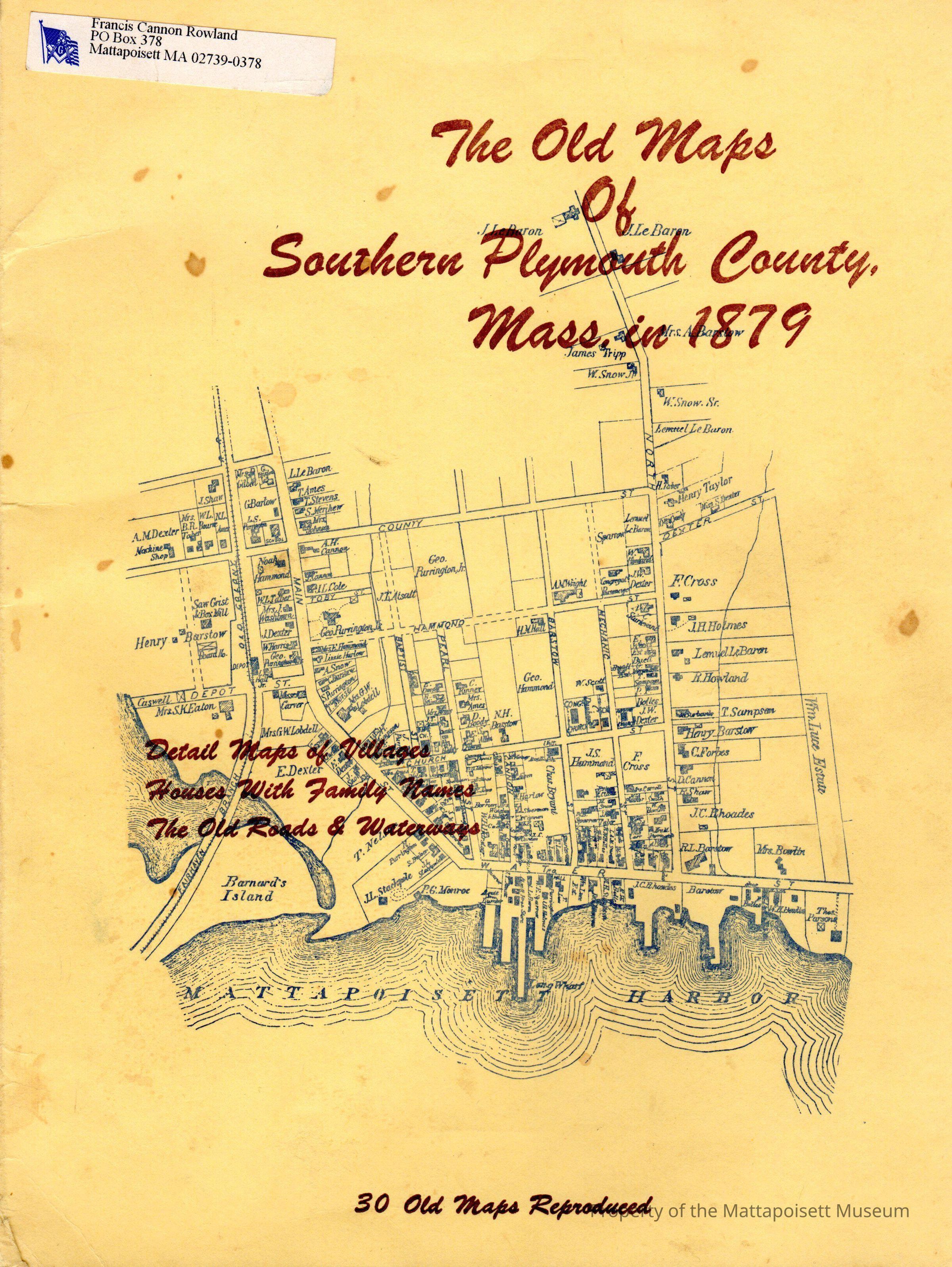
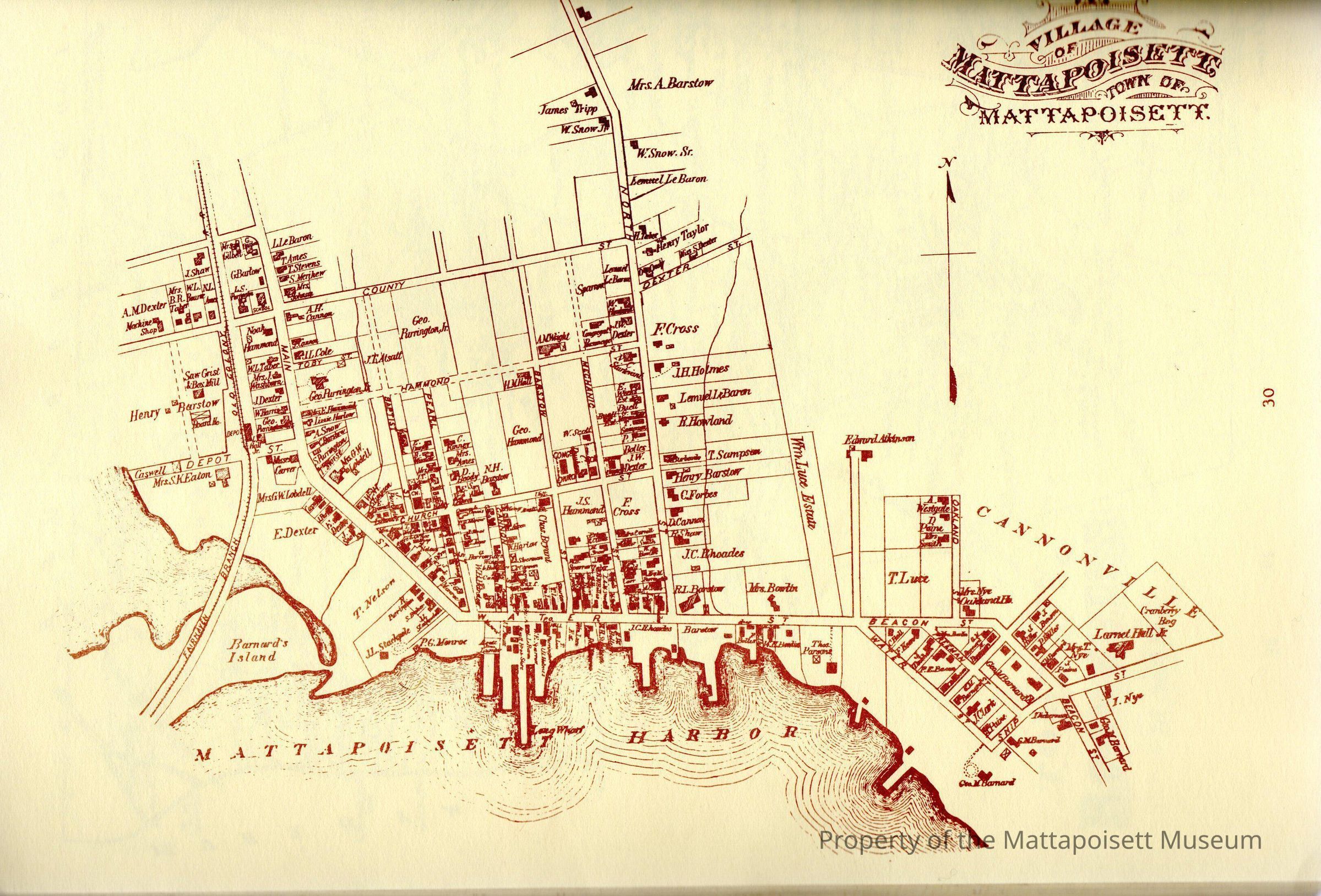
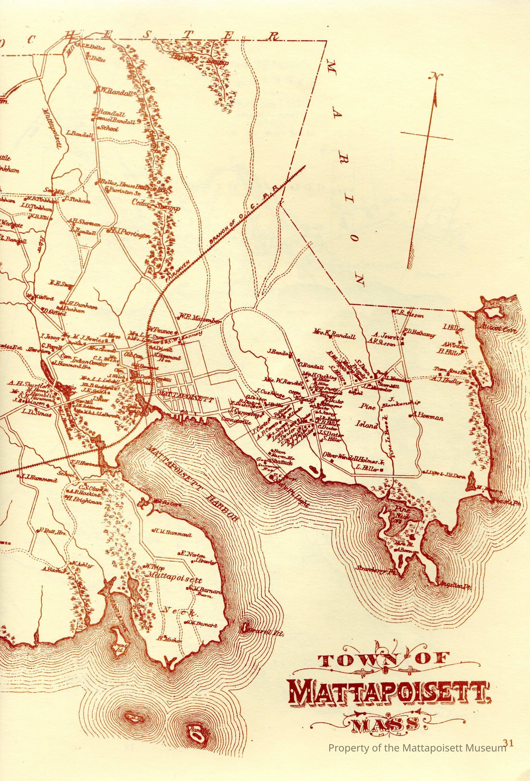
The Old Maps of Southern Plymouth County Mass, in 1879. Detail maps of villages, houses with family names, the old roads and waterways. 30 old maps reproduced. This collection of cadastral map reproductions is part of a twenty-one volume continuing series. Wareham, Carver, Bridgewater, Middleborough, Lakeville, Plymouth, Marion, Mattapoisett, Plympton, Rochester.Collection
Maps/Surveys/Blueprints (MP)Acquisition
Accession
0110.1Acquisition Method
GiftLexicon
Nomenclature 4.0
Nomenclature Secondary Object Term
MapNomenclature Primary Object Term
CartographNomenclature Sub-Class
Graphic DocumentsNomenclature Class
Documentary ObjectsNomenclature Category
Category 08: Communication ObjectsSearch Terms
Marion, MA, Mattapoisett, MA, Rochester, MA, Wareham, MAGeneral Notes
Note
Notes: Had belonged to Francis Cannon Rowland.
Status: OKCreated By
admin@catalogit.appCreate Date
February 24, 2015Updated By
admin@catalogit.appUpdate Date
August 28, 2021