Name/Title
MapEntry/Object ID
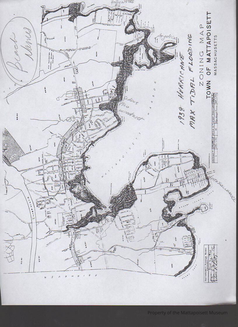
0500.2.22Scope and Content
Photocopy of 1938 Hurricane Max Tidal Flooding line. Hand-deawn on zoning map of the Town of Mattaposiett (0500.2.21) with beach names entered.Collection
Printed Documents (MDO)Acquisition
Accession
0500.2Acquisition Method
GiftLexicon
Nomenclature 4.0
Nomenclature Secondary Object Term
MapNomenclature Primary Object Term
CartographNomenclature Sub-Class
Graphic DocumentsNomenclature Class
Documentary ObjectsNomenclature Category
Category 08: Communication ObjectsLOC Thesaurus for Graphic Materials
HurricanesArchive Details
Archive Notes
Early Create Date: 1938General Notes
Note
Status: OK
Status By: Lenora Robinson
Status Date: 2016-10-16Created By
admin@catalogit.appCreate Date
October 16, 2016Updated By
admin@catalogit.appUpdate Date
August 28, 2021