Name/Title
MapEntry/Object ID
0100.1.11Description
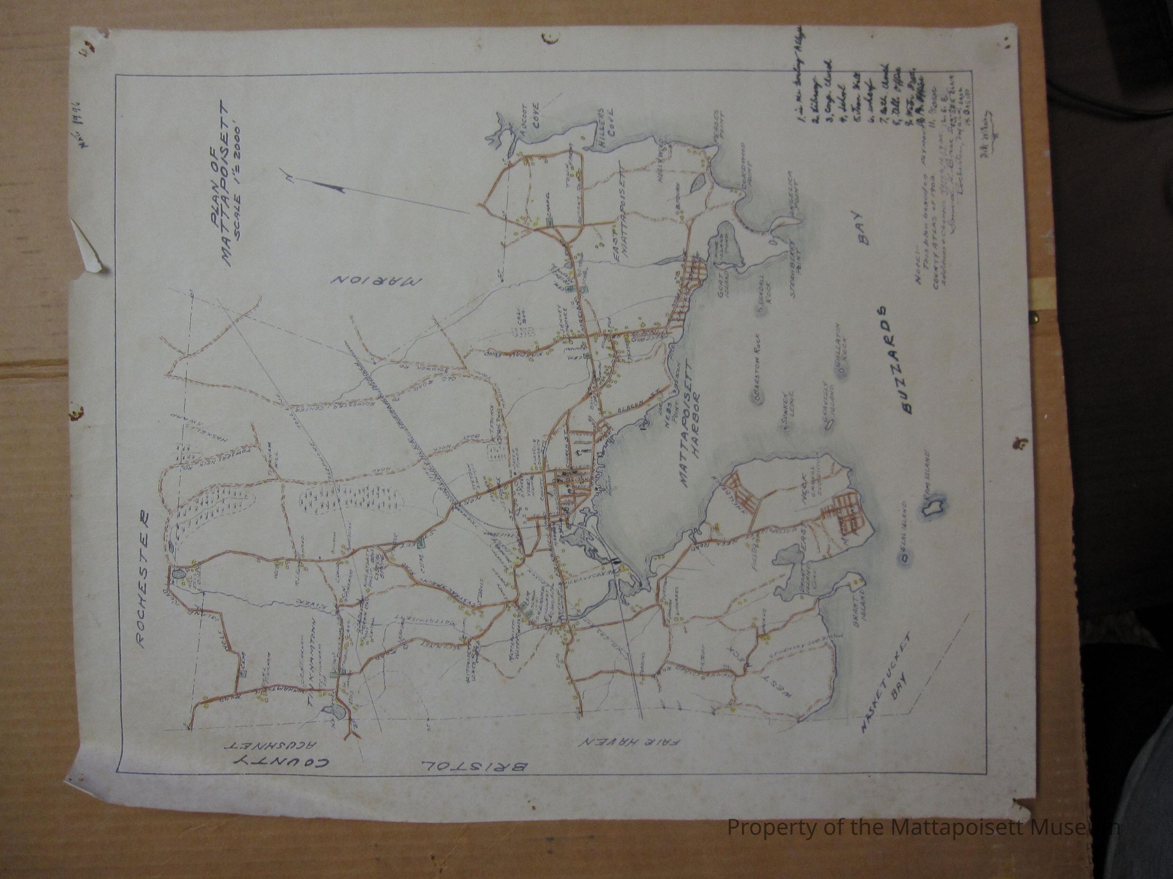
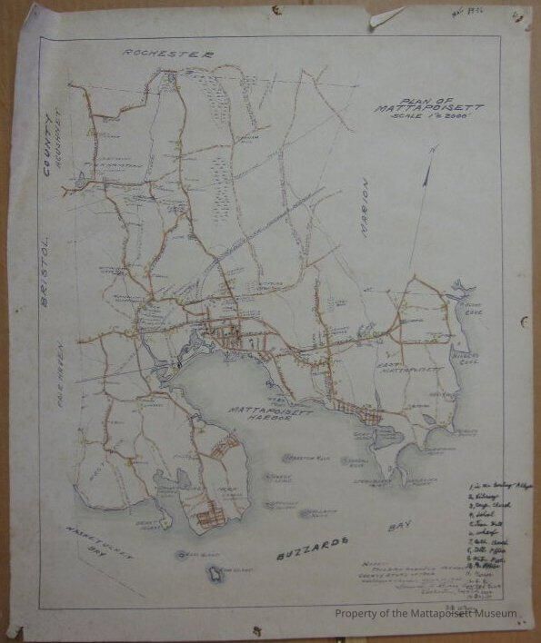
Plan of Mattapoisett, scale 1" = 2000'. This plan based on Plymouth County Atlas of 1903. Additions and changes March 12, 1935 and July 7, 1941. Samuel H. Corse, surveyor. Rochester, Mass. Map has notes for several locations in town: Bowling Alley, Library, Cong. Church, School, Town Hall, Wharf, Cath. Church, Tell. Office, Water ?, Po. Office, Manor, B. B., Sea Blain Base, Casino. Bill Winslow. Back of map says "Florence Bennett from W. H. Winslow House".Collection
Maps/Surveys/Blueprints (MP)Acquisition
Accession
0100.1Acquisition Method
GiftLexicon
Nomenclature 4.0
Nomenclature Secondary Object Term
MapNomenclature Primary Object Term
CartographNomenclature Sub-Class
Graphic DocumentsNomenclature Class
Documentary ObjectsNomenclature Category
Category 08: Communication ObjectsGeneral Notes
Note
Status: OK
Status By: Lenora Robinson
Status Date: 2016-07-01Created By
admin@catalogit.appCreate Date
July 1, 2016Updated By
admin@catalogit.appUpdate Date
August 28, 2021