Name/Title
BookEntry/Object ID
0000.5.15Scope and Content
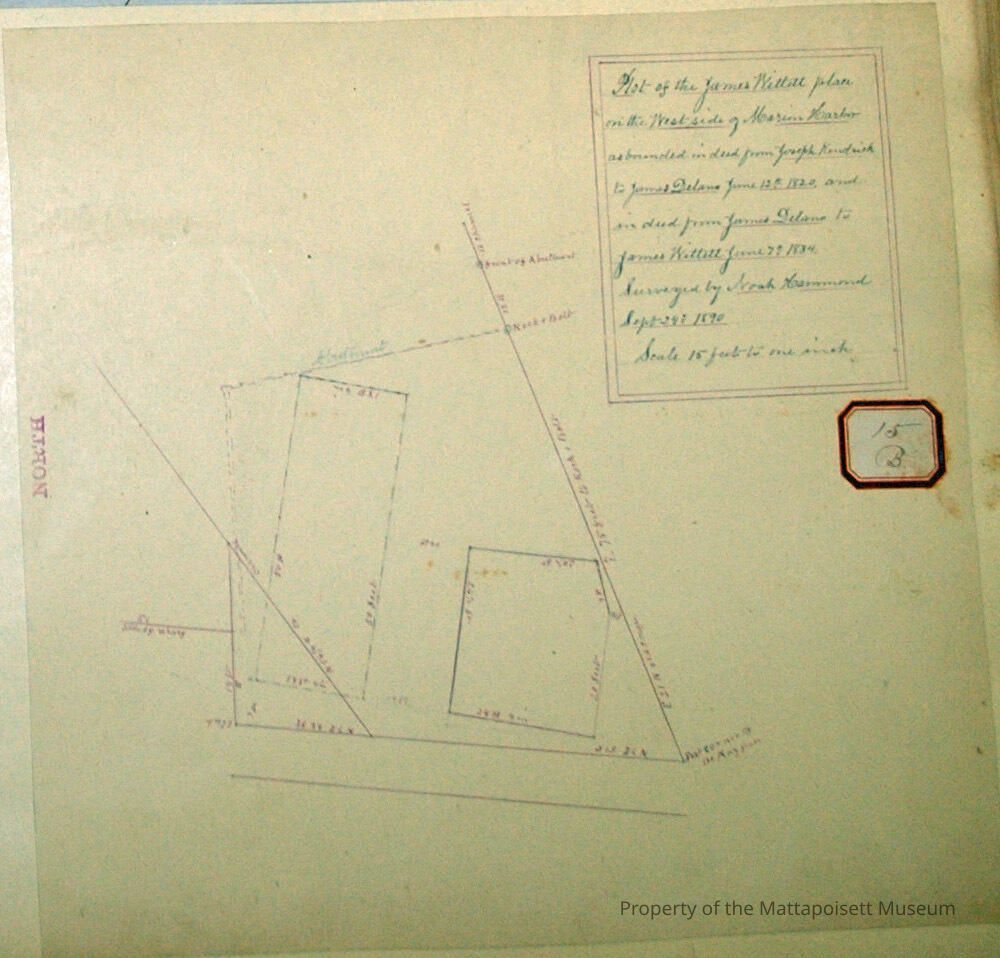
Plot of the James Wittett place on the west side of Marion Harbor as bounded in deed from Joseph Kendrick to James Delano June 12, 1820 and in deed from James Delano to James Wittett June 7, 1834. Surveyed by Noah Hammond September 24, 1890. Scale 15 feet to the inch.Acquisition
Accession
0000.5Acquisition Method
GiftLexicon
Nomenclature 4.0
Nomenclature Primary Object Term
BookNomenclature Sub-Class
Other DocumentsNomenclature Class
Documentary ObjectsNomenclature Category
Category 08: Communication ObjectsLOC Thesaurus for Graphic Materials
Land, Plans, Surveying, Surveyors, Maps, WaterfrontsSearch Terms
Marion, MA, Marion Harbor, Noah Hammond surveyorArchive Details
Date(s) of Creation
Sep 24, 1890Archive Notes
Publication Notes: September 24, 1890Other Names and Numbers
Other Numbers
Number Type
Other NumberOther Number
15bRelationships
Related Person or Organization
Person or Organization
WittettPerson or Organization
DelanoPerson or Organization
KendrickGeneral Notes
Note
Notes: Notecard:
1. Delano, Jas. (15B)
Land on west side of Marion Harbor.
Deeded to Jas. Wittett in 1834.
1890
2. Kendrick, Jos (15B)
Land on west side of Marion Harbor
Deeded to Jas. Delano in 1820
1890
3. Wittett, James (15B)
Land on west side of Marion Harbor
Deeded to Jos. Kendrick to Jas. Delano 1820
Deeded to Jas. Delano to Jas. Wittett 1834
1890
Status: OKCreated By
admin@catalogit.appCreate Date
December 2, 2014Updated By
admin@catalogit.appUpdate Date
August 28, 2021