Name/Title
BookEntry/Object ID
0000.5.18Scope and Content
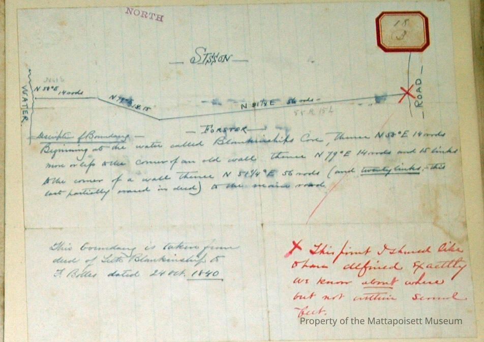
Sisson - Forster line. On lined paper. Detail of Boundry: Beginning at the water of Blankinship's cove, thence N58 E 14 rods, more or less, to the corner of an old wall, thence N74 E 14 rods 15 links to the corner of a wall, thence N 51 1/4 E 56 rods (and twenty links, this last partially erased in deed) to the main road. This boundry is taken from the deed of Seth Blankinship to F. Bolles dated 24 October 1840. This point I should like to have defined exactly, we know about where, but not written ? feet.Acquisition
Accession
0000.5Acquisition Method
GiftLexicon
Nomenclature 4.0
Nomenclature Primary Object Term
BookNomenclature Sub-Class
Other DocumentsNomenclature Class
Documentary ObjectsNomenclature Category
Category 08: Communication ObjectsLOC Thesaurus for Graphic Materials
Plans, Land, Surveying, Surveyors, MapsSearch Terms
Blankinship Cove, Great Neck, Marion, MAArchive Details
Date(s) of Creation
Oct 24, 1840Archive Notes
Publication Notes: October 24, 1840Other Names and Numbers
Other Numbers
Number Type
Other NumberOther Number
18bRelationships
Related Person or Organization
Person or Organization
SissonPerson or Organization
ForsterPerson or Organization
BlankinshipPerson or Organization
BollesGeneral Notes
Note
Notes: Notecard:
1. Forster - Sisson Line (18B)
Great Neck - Marion.
Near Blankinship's Cove
2. Sisson - Forster Line (18B)
Great Neck - Marion
Near Blankinship's Cove
Status: OKCreated By
admin@catalogit.appCreate Date
December 2, 2014Updated By
admin@catalogit.appUpdate Date
August 28, 2021