Name/Title
BookEntry/Object ID
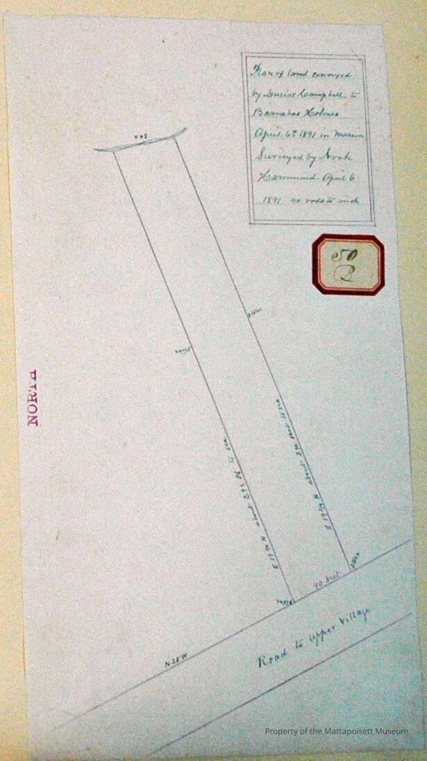
0000.5.50Scope and Content
Plan of land conveyed by Lucius Campbell to Baranabas Holmes April 6th 1891 in Marion. Surveyed by Noah Hammond April 6, 1891. 40 rods to one inch. Road to Upper Village to the east.Acquisition
Accession
0000.5Acquisition Method
GiftLexicon
Nomenclature 4.0
Nomenclature Primary Object Term
BookNomenclature Sub-Class
Other DocumentsNomenclature Class
Documentary ObjectsNomenclature Category
Category 08: Communication ObjectsLOC Thesaurus for Graphic Materials
Maps, Surveyors, Land, PlansSearch Terms
Towns, Real Estate, Maps, Geography, Marion, MA, Upper Village (Marion), Noah Hammond surveyorArchive Details
Date(s) of Creation
1891Archive Notes
Publication Notes: 1891Other Names and Numbers
Other Numbers
Number Type
Other NumberOther Number
50bRelationships
Related Person or Organization
Person or Organization
CampbellPerson or Organization
HolmesGeneral Notes
Note
Notes: Notecard:
1. Campbell, Lucius. (50B)
Lot - Marion.
On road to upper villiage.
Later owned by Barnabas Holmes.
1891.
2. Holmes, Barnabas (50B)
Lot- Marion
On road to upper village
1891
Status: OKCreated By
admin@catalogit.appCreate Date
December 3, 2014Updated By
admin@catalogit.appUpdate Date
August 28, 2021