Name/Title
BookEntry/Object ID
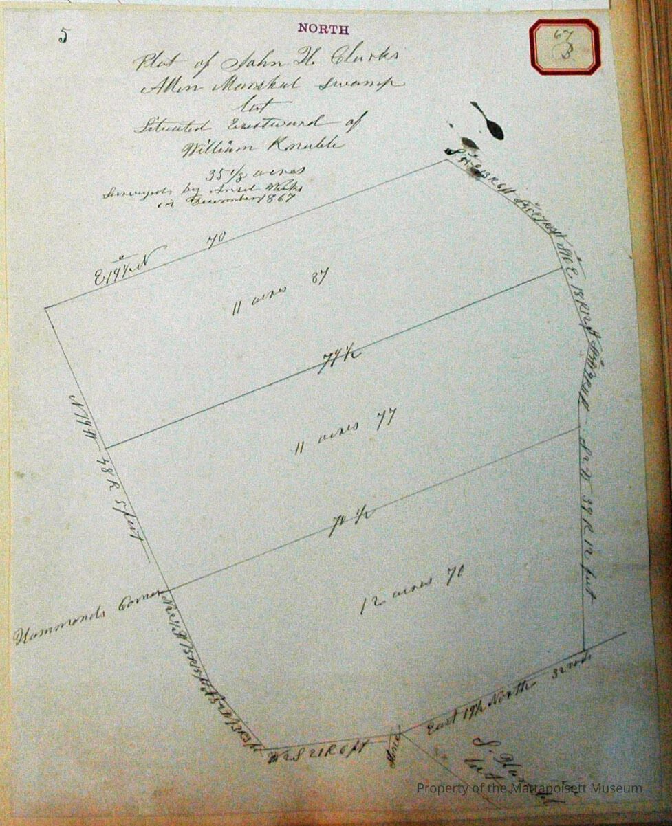
0000.5.67Scope and Content
Plot of John H. Clark's Allen Marshal swamp lot. Situated eastward of William Knuble (?). 35 1/8 acres, in three sections (11 acres and 87 rods, 11 acres and 77 rods, 12 acres and 70 rods). Surveyed by Ansel Weeks in December 1867Acquisition
Accession
0000.5Acquisition Method
GiftLexicon
Nomenclature 4.0
Nomenclature Primary Object Term
BookNomenclature Sub-Class
Other DocumentsNomenclature Class
Documentary ObjectsNomenclature Category
Category 08: Communication ObjectsLOC Thesaurus for Graphic Materials
Maps, Surveyors, Land, Plans, Land subdivisionSearch Terms
Towns, Real Estate, Maps, Geography, Ansel Weeks surveyorArchive Details
Date(s) of Creation
1867Archive Notes
Publication Notes: 1867Other Names and Numbers
Other Numbers
Number Type
Other NumberOther Number
67bRelationships
Related Person or Organization
Person or Organization
ClarkPerson or Organization
MarshalPerson or Organization
EllisPerson or Organization
LeBaronGeneral Notes
Note
Notes: Notecard:
1. Clark, John H. (89A, 67B)
Allen Marshall Swamp.
Later divided between Jasmes LeBaron and Thomas Ellis.
Town Plot 900N by 200W.
1867
2. Ellis, Thomas (89A, 67B)
South part of J. H. Clark's Marshall Swamp
Town Plot 900N by 200W
1867
3. LeBaron, James (89A, 67B)
North part of J. H. Clark's Marshall Swamp
Town Plot 925N by 200W
1867
4. Marshal, Allen (89A & 67B)
Swamp land
Owned by John H. Clark
Town Plot 900N by 200W
1867
Status: OKCreated By
admin@catalogit.appCreate Date
December 8, 2014Updated By
admin@catalogit.appUpdate Date
August 28, 2021