Name/Title
Drawing, TechnicalEntry/Object ID
0500.6.442Scope and Content
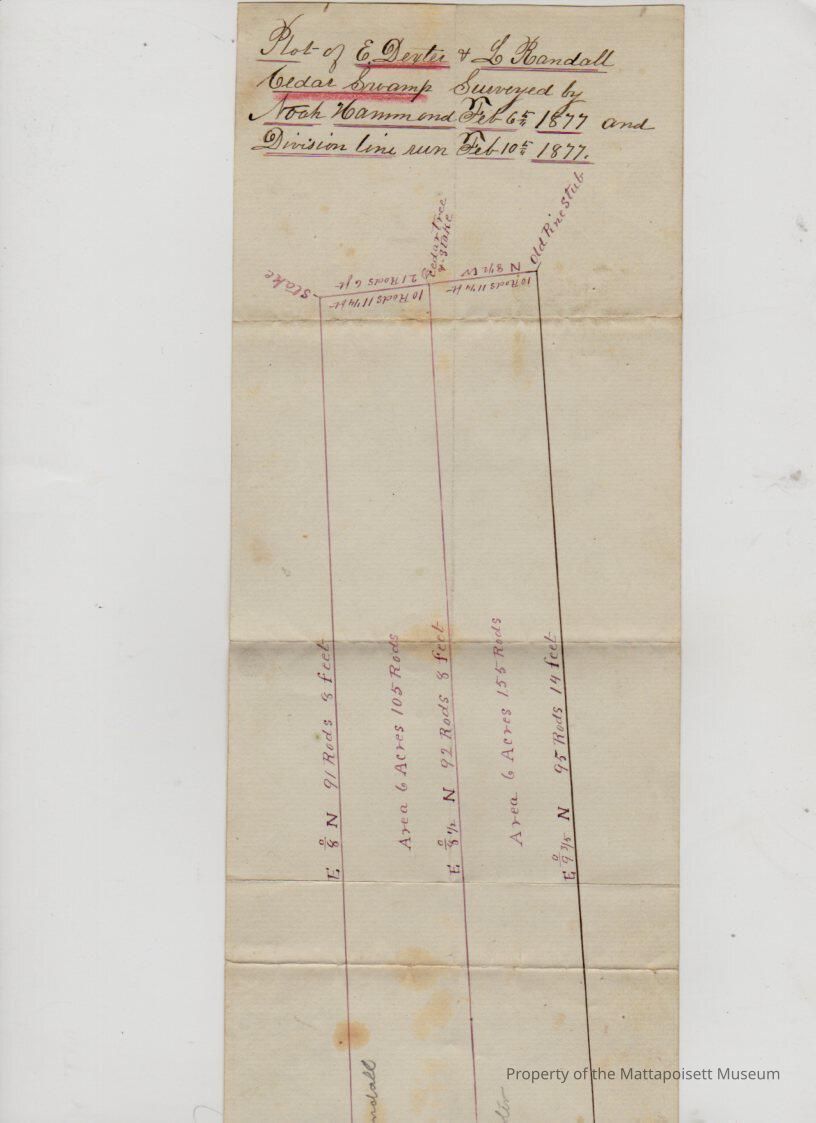
Plot of E. Dexter & L. Randall Cedar Swamp, surveyed by Noah Hammond February 6, 1877. Plan identifies division line. Areas 6 acres and 105 rods, 6 acres and 155 rods.Collection
Printed Documents (MDO)Acquisition
Accession
0500.6Acquisition Method
GiftLexicon
Nomenclature 4.0
Nomenclature Secondary Object Term
Drawing, TechnicalNomenclature Primary Object Term
ProjectionNomenclature Sub-Class
Graphic DocumentsNomenclature Class
Documentary ObjectsNomenclature Category
Category 08: Communication ObjectsSearch Terms
Cedar Swamp, Noah Hammond surveyorArchive Details
Date(s) of Creation
1877 - 1877Archive Notes
Date(s): 02/10/1877Relationships
Related Person or Organization
Person or Organization
DexterPerson or Organization
RandallGeneral Notes
Note
Status: OK
Status By: Lenora Robinson
Status Date: 2017-06-04Created By
admin@catalogit.appCreate Date
June 4, 2017Updated By
admin@catalogit.appUpdate Date
August 28, 2021