Name/Title
BookEntry/Object ID
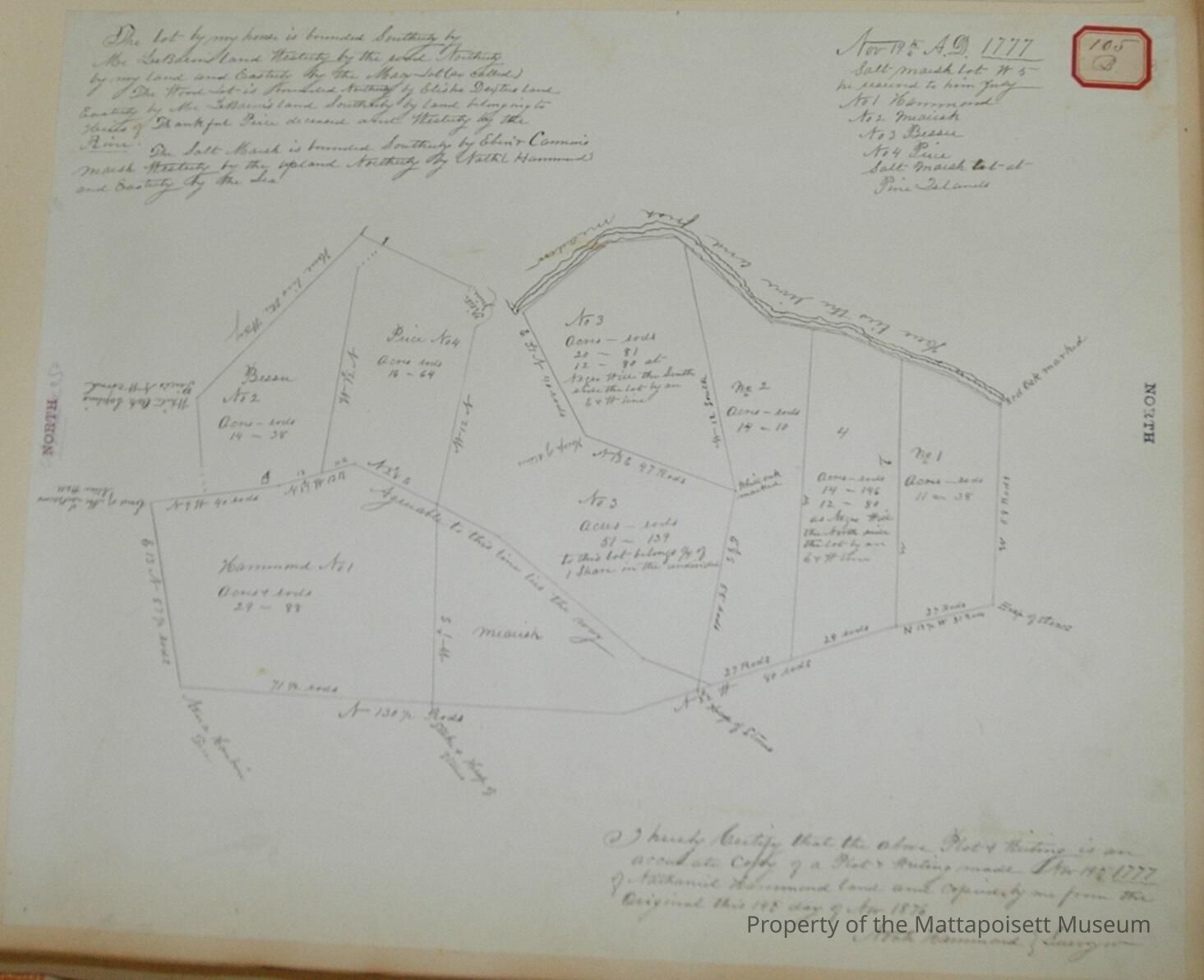
0000.5.105Scope and Content
The lot by my house is bounded southerly by Mr. LeBaron's land, westerly by the road, northerly by my land and easterly by the Macy lot (so called). The wood lot is bounded northerly by Elisha Dexter's land, easterly by Mr. LeBaron's land, Southerly by land belonging to Heirs of Thankful Piece, deceased, and westerly by the . The salt marsh is bounded southerly by Ebenezer Cannon's marsh, westerly by the upland, northerly by Nathaniel Hammond's and southerly by the sea.
I hereby certifiy that the above plot and writing is an accurate copy of a plot and writing made November 19, 1777 of Nathaniel Hammond land and copied by me from the original this 19th day of August 1876. Noah Hammond, Suveyor.
River and fresh meadow. November 19th A.D. 1777. Salt-marsh lot W5, be reserved to him July. No. 1 Hammond, No. 2 Miausk, No. 3. Bessie, No. 4 Price, Salt-marsh lot at Pine Island.Acquisition
Accession
0000.5Acquisition Method
GiftLexicon
Nomenclature 4.0
Nomenclature Primary Object Term
BookNomenclature Sub-Class
Other DocumentsNomenclature Class
Documentary ObjectsNomenclature Category
Category 08: Communication ObjectsLOC Thesaurus for Graphic Materials
Land, Land subdivisionSearch Terms
Real EstateOther Names and Numbers
Other Numbers
Number Type
Other NumberOther Number
105bRelationships
Related Person or Organization
Person or Organization
HammondPerson or Organization
PricePerson or Organization
LeBaronGeneral Notes
Note
Notes: Notecard:
Hammond, Nathaniel (105B)
Division plan of land.
Copy of plot of 1777
Status: OKCreated By
admin@catalogit.appCreate Date
December 8, 2014Updated By
admin@catalogit.appUpdate Date
August 28, 2021