Name/Title
BookEntry/Object ID
0000.5.130Scope and Content
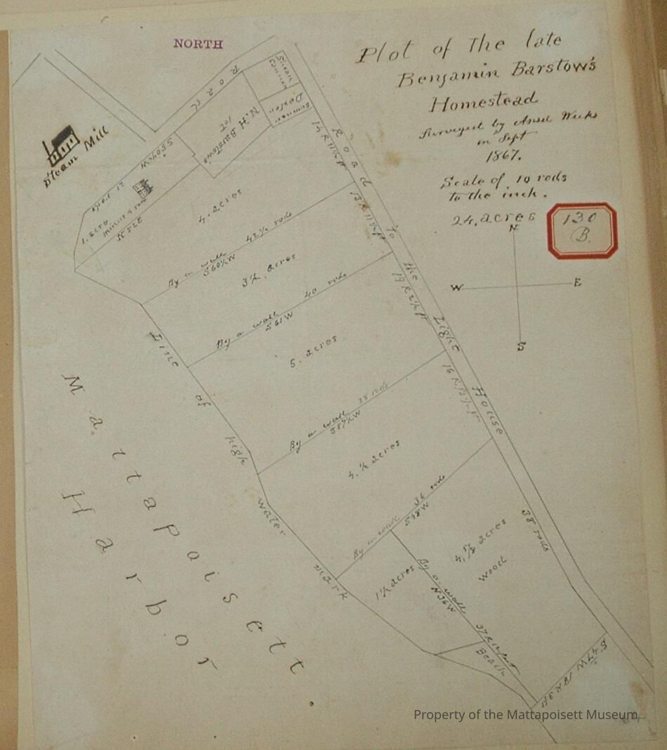
Plot of the late Benjamin Barstow's Homestead. Surveyed by Ansel Weeks in September 1867. Scale of 10 rods to the inch. 24 acres at Mattapoisett Harbor on Ship Street and Road to the Light House. Split into nine sections 1. 4 5/8 acres, wood; 1 1/2 acres; 4 1/2 acres, 5 acres; 3 1/2 acres; 4 acres; Samuel (?) Dexter; Susan Cannon; N. H. Barstow's lot; 1 acre, minus 4 rods.Acquisition
Accession
0000.5Acquisition Method
GiftLexicon
Nomenclature 4.0
Nomenclature Primary Object Term
BookNomenclature Sub-Class
Other DocumentsNomenclature Class
Documentary ObjectsNomenclature Category
Category 08: Communication ObjectsLOC Thesaurus for Graphic Materials
Land, Land subdivision, WaterfrontsSearch Terms
Real Estate, Ship Street, Light House Road, Ansel Weeks surveyor, Mattapoisett HarborArchive Details
Date(s) of Creation
1867Archive Notes
Publication Notes: 1867Other Names and Numbers
Other Numbers
Number Type
Other NumberOther Number
130bRelationships
Related Person or Organization
Person or Organization
BarstowPerson or Organization
CannonPerson or Organization
DexterGeneral Notes
Note
Notes: Notecard:
Barstow, Benjamin (130B, 137A)
Homestead - Cannonville
On Ship Street and Light House Road
1867
Status: OKCreated By
admin@catalogit.appCreate Date
December 9, 2014Updated By
admin@catalogit.appUpdate Date
August 28, 2021