Name/Title
BookEntry/Object ID
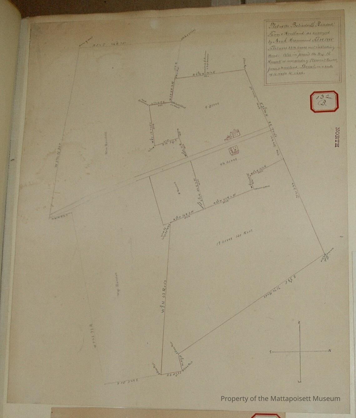
0000.5.132Scope and Content
Plot of the Belinda L. Randall farm and woodland as surveyed by Noah Hammond, February 3rd 1885. Totaling 33 1/2 acres not inluding (Randall) road. Also in pencil the William R. Randall or remainer of Clement Randall farm and woodland. Drawn on a scale of 10 rods to the inch. Divided into several lots. 9 acres, 4 1/2 acres, 19 acres and 130 rods, William Randall and C. Randall lots.Acquisition
Accession
0000.5Acquisition Method
GiftLexicon
Nomenclature 4.0
Nomenclature Primary Object Term
BookNomenclature Sub-Class
Other DocumentsNomenclature Class
Documentary ObjectsNomenclature Category
Category 08: Communication ObjectsLOC Thesaurus for Graphic Materials
Land, Land subdivisionSearch Terms
Real Estate, Noah Hammond surveyor, Randall RoadArchive Details
Date(s) of Creation
1885Archive Notes
Publication Notes: 1885Other Names and Numbers
Other Numbers
Number Type
Other NumberOther Number
132bRelationships
Related Person or Organization
Person or Organization
RandallGeneral Notes
Note
Notes: Notecard:
1. Dexter, J. L. (132B & 279B)
Part of Belinda Randall Farm and Wood Land
Near Randall Road
Town Plot 175N by 325E
1885
2. Randall, Belinda L. (132B, 279B)
Farm and Wood Land
Crossed by Randall Road
Later divided and owned by Stetson, J. L. Dexter and F. Randall
Town Plot 150N by 300E
1885
3. Randall, F. (132B & 279B)
Part of Belinda Farm and Wood land
Near Randall Road
Town Plot 150N by 350E
1885
4. Stetson, E. C. (132B & 279B)
Part of Belinda Randall Farm and Wood land
Crossed by Randall Road
Town Plot 150N by 300E
1885
Status: OKCreated By
admin@catalogit.appCreate Date
December 10, 2014Updated By
admin@catalogit.appUpdate Date
August 28, 2021