Name/Title
BookEntry/Object ID
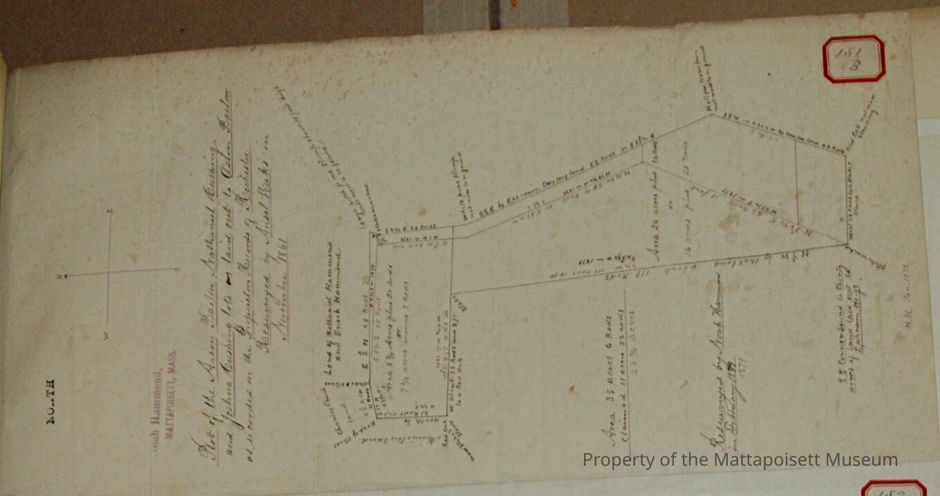
0000.5.151Scope and Content
Plot of the Aaron Barlow Nathaniel Cushing and Joshua Cushing lots as laid out to Aaron Barlow as recoded on the Proprietor's of Records of Rochester. Resurveyed by Ansel Weeks in November 1861. Re-resurveyed by Noah Hammond in February 1879. Abutters: Nathaniel and Enoch Hammond, Charles Church, Minister's land, Ephraim Meigs.Acquisition
Accession
0000.5Acquisition Method
GiftLexicon
Nomenclature 4.0
Nomenclature Primary Object Term
BookNomenclature Sub-Class
Other DocumentsNomenclature Class
Documentary ObjectsNomenclature Category
Category 08: Communication ObjectsLOC Thesaurus for Graphic Materials
LandSearch Terms
Real Estate, Minister's Island, Ansel Weeks surveyor, Noah Hammond surveyor, Rochester, MAOther Names and Numbers
Other Numbers
Number Type
Other NumberOther Number
151bRelationships
Related Person or Organization
Person or Organization
BarlowPerson or Organization
CushingPerson or Organization
HammondPerson or Organization
MeigsPerson or Organization
ChurchGeneral Notes
Note
Notes: Notecard:
1. Barlow, Aaron. (71B & 151B, 134A)
Nathaniel and Joshua Cushing Lot.
Land lying either side of Main Street.
Later owned by Atkinson and James Luce.
Town Plot 0 by 50E
1861 & 1879
2. Cushing Nathaniel and Joshua (71B & 151B, 134A)
Land lyying either side of Main Street.
Later owned by Atkinson and James Luce.
Town Plot 0 by 50E.
1861 & 1879
3. Luce, James (71B, 151B)
Lot east of Atkinson Place
Town Plot 0 by 50E
1861 & 1879
4. Sturtevant, Samuel (71B, 151B, 134A)
Land crossed by Main Sttreet
Later owned by Edward Atkinson
Town Plot 0 by 50E
1861 & 1879
5. Atkinson, Edward (71B, 151B, 134A)
Samuel Sturtevant Place
Town Plot 0 by 50E
1861 & 1879Created By
admin@catalogit.appCreate Date
December 3, 2014Updated By
admin@catalogit.appUpdate Date
August 28, 2021