Name/Title
BookEntry/Object ID
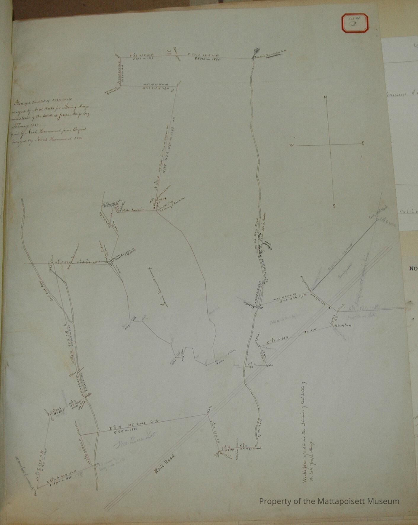
0000.5.154Scope and Content
Plan of a wood lot of 218 1/2 acres surveyed by Ansel Weeks for Loring Meigs, administrator of the Estate of Joseph Meigs, Esq. February 1847. Copied by Noah Hammond from original, surveyed by Noah Hammond 1885. Lewis Randall's swamp in the middle, Railroad runs through, on Mattapoisett/Marion town line, on Boat-Rock Road. Abutters: William Luce, Nathaniel Ames, N. Broody, L. Hall, Jr., Elisha Dexter, Abraham Tinkham, James LeBaron, Meigs.Acquisition
Accession
0000.5Acquisition Method
GiftLexicon
Nomenclature 4.0
Nomenclature Primary Object Term
BookNomenclature Sub-Class
Other DocumentsNomenclature Class
Documentary ObjectsNomenclature Category
Category 08: Communication ObjectsLOC Thesaurus for Graphic Materials
Land, Land subdivisionSearch Terms
Real Estate, Mattapoisett, MA, Marion, MA, Noah Hammond surveyor, Boat-RockArchive Details
Archive Notes
Date(s): 1847 & 1885
Publication Notes: 1847 & 1885Other Names and Numbers
Other Numbers
Number Type
Other NumberOther Number
154bRelationships
Related Person or Organization
Person or Organization
MeigsPerson or Organization
LeBaronPerson or Organization
TinkhamPerson or Organization
DexterPerson or Organization
HallPerson or Organization
RandallPerson or Organization
LucePerson or Organization
AmesGeneral Notes
Note
Notes: Notecard:
1. Durfee, Edward (154B & 329B)
Part of Meigs 200 acre wood lot
Bought of L. hall
Town Plot 650N by 200E
1847 & 1885
2. Hall, L. Jr (154B & 329B)
Part of Meigs 200 acre wood lot
Crossed by Railroad
Later owned by Edward Durfee
Town Plot 650N by 200E
1847 & 1885
3. Meigs, Joseph (154B & 329B)
200 Acre Wood Lot
Crossed by Boat-Rock Road
Town Plot 700N by 125E
1847 & 1885
4. Randall, Lewis (80A, 154B, 329B)
Church Swamp
Bounds between above and J. Tinkham and E. C. Stetson
Town Plot 700N by 50E
1847, 1883, 1885
Status: OKCreated By
admin@catalogit.appCreate Date
December 10, 2014Updated By
admin@catalogit.appUpdate Date
August 28, 2021