Name/Title
BookEntry/Object ID
0000.5.174Scope and Content
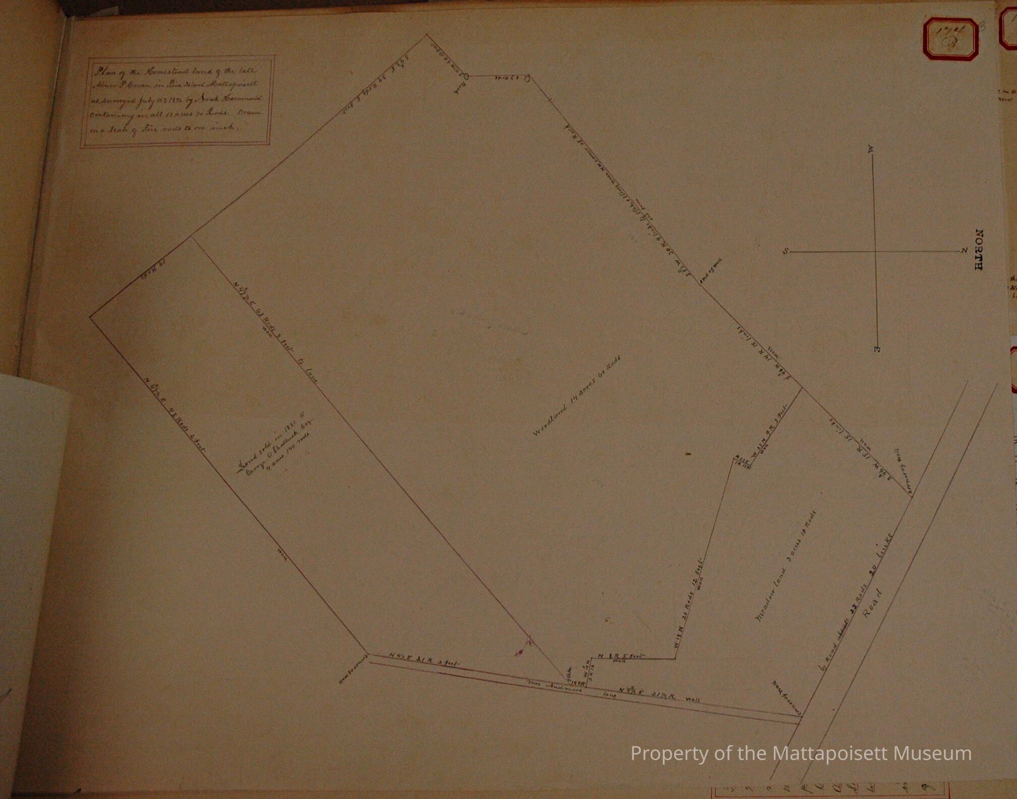
Plan of the Homestead land of the late Abner P. Cowen in Pine Island Mattapoisett as surveyed July 12th, 1892 by Noah Hammond. Containing in all 17 acres and 70 rods. Drawn on a scale of four rods to one inch.
Divided: Land sold in 1881 to George O. Shattuck, Esq., 4 acres and 140 rods. Woodland at 14 acres and 60 rods, Meadow land at 3 acres and 10 rods. On Mrs. Andrew's Lane and road.Acquisition
Accession
0000.5Acquisition Method
GiftLexicon
Nomenclature 4.0
Nomenclature Primary Object Term
BookNomenclature Sub-Class
Other DocumentsNomenclature Class
Documentary ObjectsNomenclature Category
Category 08: Communication ObjectsLOC Thesaurus for Graphic Materials
Land, Land subdivisionSearch Terms
Real Estate, Pine Island, Noah Hammond surveyorArchive Details
Date(s) of Creation
1892Archive Notes
Publication Notes: 1892Other Names and Numbers
Other Numbers
Number Type
Other NumberOther Number
174bRelationships
Related Person or Organization
Person or Organization
ShattuckPerson or Organization
CowenGeneral Notes
Note
Notes: Notecard:
1. Cowen, Abner (174B)
Homestead, Meadow and Wood Land On Lower Road - Pine Island
Part sold to Geo. Shattuck in 1881
Town Plot 150S by 200E
1892
2. Shattuck, George O. (174B)
Part of Abner Cowen's Land
On Mrs. Andrew's Lane
Town Plot 100S by 200E
1892
Status: OKCreated By
admin@catalogit.appCreate Date
December 10, 2014Updated By
admin@catalogit.appUpdate Date
August 28, 2021