Name/Title
BookEntry/Object ID
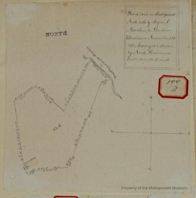
0000.5.199Scope and Content
Plot of land on Mattapoisett Neck sold by Myra S. Mosher to Andrew Denham. November 27th, 1896. Surveyed and drawn by Noah Hammond. Scale 10 rods to the inch. Area 5 ½ acres on Mattapoisett Harbor.Acquisition
Accession
0000.5Acquisition Method
GiftLexicon
Nomenclature 4.0
Nomenclature Primary Object Term
BookNomenclature Sub-Class
Other DocumentsNomenclature Class
Documentary ObjectsNomenclature Category
Category 08: Communication ObjectsLOC Thesaurus for Graphic Materials
Land, WaterfrontsSearch Terms
Real Estate, Noah Hammond surveyor, Mattapoisett Harbor, Mattapoisett NeckArchive Details
Date(s) of Creation
1896Archive Notes
Publication Notes: 1896Other Names and Numbers
Other Numbers
Number Type
Other NumberOther Number
199bRelationships
Related Person or Organization
Person or Organization
MosherPerson or Organization
DenhamGeneral Notes
Note
Notes: No notecards.
Status: OKCreated By
admin@catalogit.appCreate Date
January 6, 2015Updated By
admin@catalogit.appUpdate Date
August 28, 2021