Name/Title
BookEntry/Object ID
0000.5.228Scope and Content
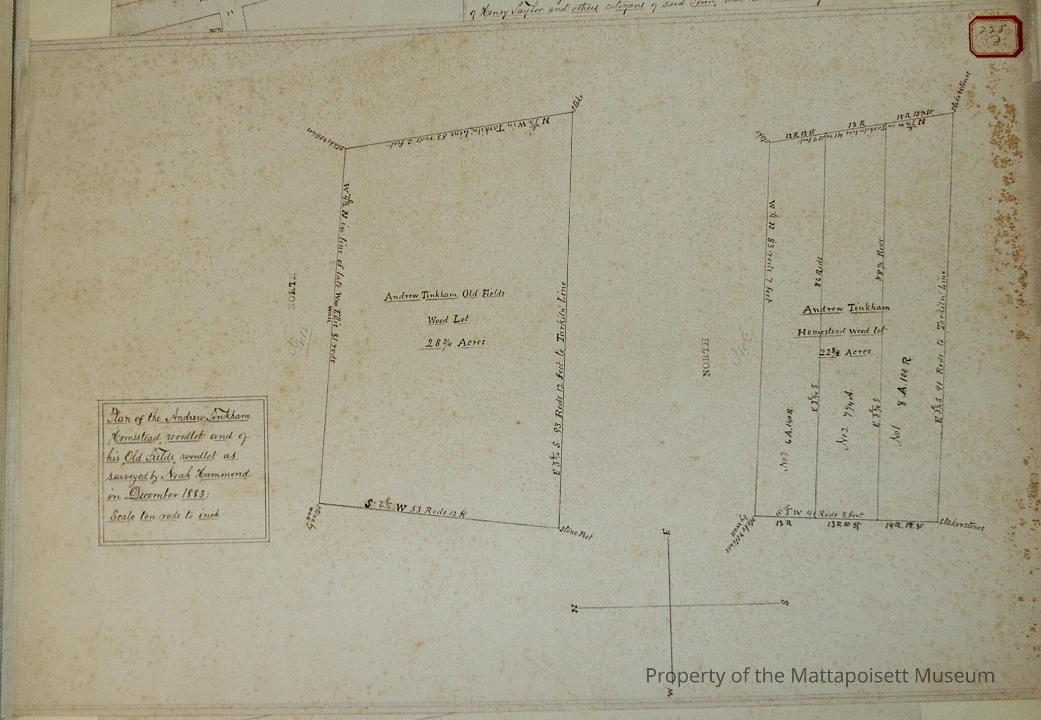
Plan of the Andrew Tinkham Homestead woodlot and of his Old Fields woodlot as surveyed by Noah Hammond in December 1883. Scale ten rods to the inch. 28 ¾ acres. Tarkiln, Ellis abutters. Also Andrew Tinkham Homestead wood lot at 22 ¾ acres, divided into three no. 1 8 acres and 100 rods, no. 2 7 ¼ acres, no. 3 6 acres and 140 rods.Acquisition
Accession
0000.5Acquisition Method
GiftLexicon
Nomenclature 4.0
Nomenclature Primary Object Term
BookNomenclature Sub-Class
Other DocumentsNomenclature Class
Documentary ObjectsNomenclature Category
Category 08: Communication ObjectsLOC Thesaurus for Graphic Materials
Land, Land subdivisionSearch Terms
Real Estate, Noah Hammond surveyorArchive Details
Date(s) of Creation
1883Archive Notes
Publication Notes: 1883Other Names and Numbers
Other Numbers
Number Type
Other NumberOther Number
228bRelationships
Related Person or Organization
Person or Organization
TinkhamPerson or Organization
EllisPerson or Organization
TarklinGeneral Notes
Note
Notes: Notecard:
1. Rounseville, A. (228B)
Andrew Tinkham "Old Fields" wood lot
Town Plot 800N by 550W
1883
2. Tinkham, Andrew (228B)
Homestead wood lot
Later owned by C. & T. Tinkham
Town Plot 725N by 550W
1883
3. Tinkham, Andrew (228B)
"Old Fields" wood lot
Later owned by A. Rounesville
Town Plot 800N by 550W
1883
4. Tinkham, C. & T. (228B)
Andrew Tinkham Homestead wood lot
Town Plot 725N by 550W
1883
Status: OKCreated By
admin@catalogit.appCreate Date
December 17, 2014Updated By
admin@catalogit.appUpdate Date
August 28, 2021