Name/Title
BookEntry/Object ID
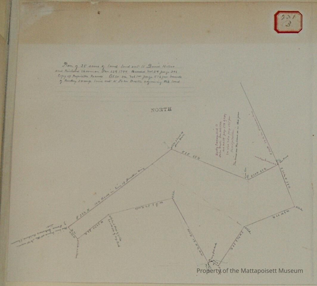
0000.5.231Scope and Content
Plan of 25 acres of land laid out to David Hiller and Richard Sherman January 24nd, 1794. Vol. 24, page 393, copy of Proprietors records. Also see - vol. 1, page 578 per bounds of Rocky swamp laid out to John Dexter adjoining this land.
Rocky Swamp laid out to John Dexter January 24th 1742. Recorded vol. 1 page 578 of copy. See vol. 2 page 195 for re-edification. The line are the same in this plan.
Chapman, James LeBaron, Richard Sherman and Jonathan Wing abuttors.Acquisition
Accession
0000.5Acquisition Method
GiftLexicon
Nomenclature 4.0
Nomenclature Primary Object Term
BookNomenclature Sub-Class
Other DocumentsNomenclature Class
Documentary ObjectsNomenclature Category
Category 08: Communication ObjectsLOC Thesaurus for Graphic Materials
LandSearch Terms
Real Estate, Rocky Swamp, Marion, MAArchive Details
Date(s) of Creation
1794Archive Notes
Publication Notes: 1794Other Names and Numbers
Other Numbers
Number Type
Other NumberOther Number
231bRelationships
Related Person or Organization
Person or Organization
DexterPerson or Organization
LeBaronPerson or Organization
WingPerson or Organization
ShermanPerson or Organization
HillerGeneral Notes
Note
Notes: Notecard:
1. Hiller, David and Richard Sherman (231B)
Old layout of land south of Rocky Swamp - Marion (1794)
2. Sherman, Richard and David Hiller (231B)
Old layout of land south of Rocky Swamp - Marion (1794)
Status: OKCreated By
admin@catalogit.appCreate Date
December 17, 2014Updated By
admin@catalogit.appUpdate Date
August 28, 2021