Name/Title
BookEntry/Object ID
0000.5.245Scope and Content
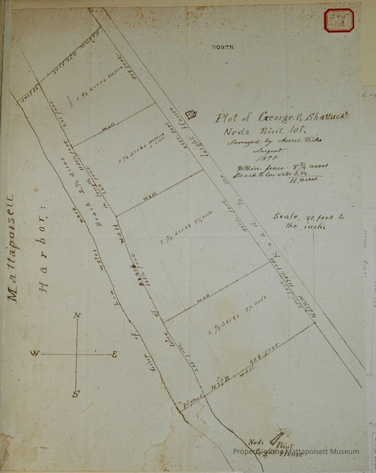
Plot of George O. Shattuck Ned's Point lot. Surveyed by Ansel Weeks, August 1871. Within fence 8 ¾ acres, beach to low water 2 ¼ acres. 11 acres total. Scale 80 feet to the inch. On Road to the Light House, Mattapoisett Harbor. Four divisions 2 1/8 acres 9 ½ rods, 2 7/8 acres and 7 1/8 rods, 1 ¾ acres minus 1 rod, 1 ¾ acres and 54 rods.Acquisition
Accession
0000.5Acquisition Method
GiftLexicon
Nomenclature 4.0
Nomenclature Primary Object Term
BookNomenclature Sub-Class
Other DocumentsNomenclature Class
Documentary ObjectsNomenclature Category
Category 08: Communication ObjectsLOC Thesaurus for Graphic Materials
Beaches, Waterfronts, Land, Land subdivisionSearch Terms
Ned's Point, Ansel Weeks surveyor, Mattapoisett HarborArchive Details
Date(s) of Creation
1871Archive Notes
Publication Notes: 1871Other Names and Numbers
Other Numbers
Number Type
Other NumberOther Number
245bRelationships
Related Person or Organization
Person or Organization
ShattuckGeneral Notes
Note
Notes: Notecard:
Shattuck, George O. (245B & 293B)
Ned Point Light
West side of Light House Road
Later owned by Hamlin and others
Town Plot 175S by 200E
1871
Status: OKCreated By
admin@catalogit.appCreate Date
December 22, 2014Updated By
admin@catalogit.appUpdate Date
August 28, 2021