Name/Title
BookEntry/Object ID
0000.5.282Scope and Content
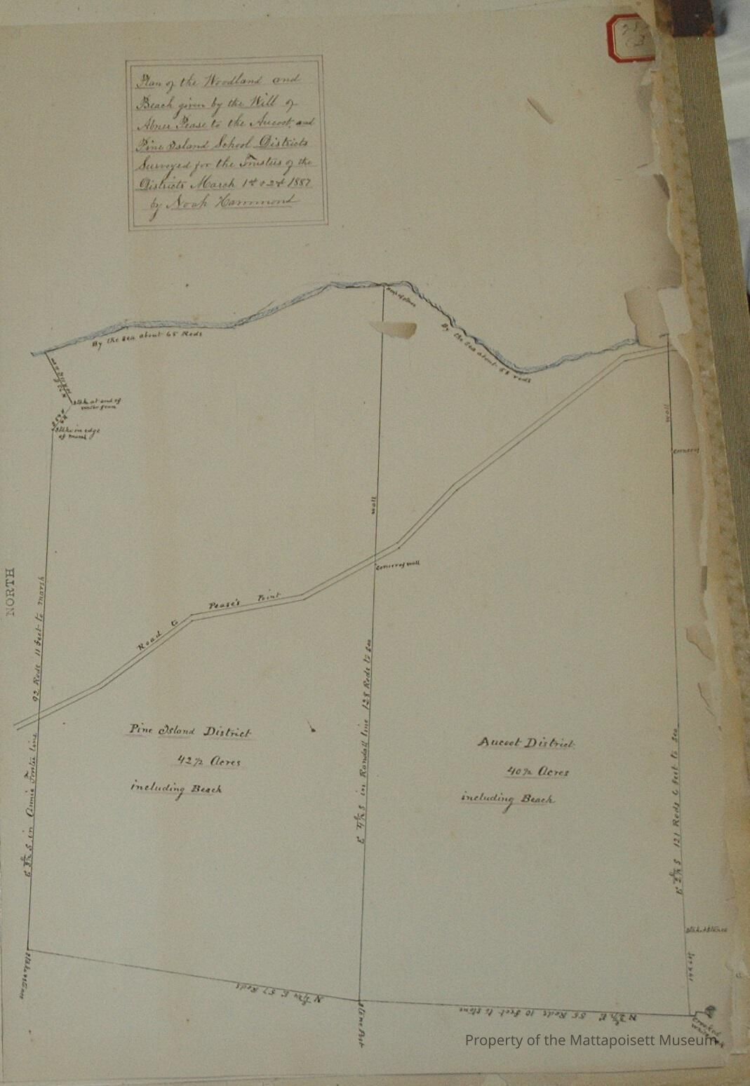
Plan of the woodland and beach given by the will of Abner Pease to the Aucoot and Pine Island School Districts. Surveyed for the Trustees of the Districts March 1st 1887 by Noah Hammond. Road to Pease's Point runs through. Pine Island District 42 ½ acres, including beach. Aucoot District 40 ½ acres, including beach. Annie Forster and Randall, abutting.Acquisition
Accession
0000.5Acquisition Method
GiftLexicon
Nomenclature 4.0
Nomenclature Primary Object Term
BookNomenclature Sub-Class
Other DocumentsNomenclature Class
Documentary ObjectsNomenclature Category
Category 08: Communication ObjectsLOC Thesaurus for Graphic Materials
Land, Waterfronts, SchoolsSearch Terms
Real Estate, Aucoot, Pine Island, Noah Hammond surveyorArchive Details
Date(s) of Creation
1887Archive Notes
Publication Notes: 1887Other Names and Numbers
Other Numbers
Number Type
Other NumberOther Number
282bRelationships
Related Person or Organization
Person or Organization
PeasePerson or Organization
Forster/ForresterPerson or Organization
RandallGeneral Notes
Note
Notes: Notecard:
1. Aucoot District (282B)
Lot given to Aucoot School District by Abner Pease
Town Plot 100S by 800E
1887
2. Pease, Abner (282B)
Aucoot and Pine Island School District lots
Town Plot 100S by 800E
1887
3. Pine Island District (282B)
Lot given to Pine Island School District by Abner Pease
Town Plot 100S by 800E
1887
Status: OKCreated By
admin@catalogit.appCreate Date
December 16, 2014Updated By
admin@catalogit.appUpdate Date
August 28, 2021