Name/Title
BookEntry/Object ID
0000.5.283Scope and Content
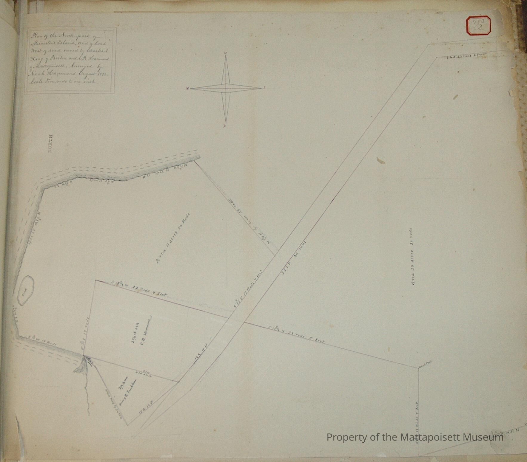
Plan of the north part of Minister's Island and of land west of road owned by Charles A. King of Boston and C. B. Hammond of Mattapoisett. Surveyed by Noah Hammond August 1832. Scale five rods to the inch. Heirs of C. J. Tinkham ¾ acres, C. B. Hammond 2 ¾ acres and 27 rods, division area 11 acres and 56 (northwest of road) rods and 29 acres and 30 rods (southeast of road).Acquisition
Accession
0000.5Acquisition Method
GiftLexicon
Nomenclature 4.0
Nomenclature Primary Object Term
BookNomenclature Sub-Class
Other DocumentsNomenclature Class
Documentary ObjectsNomenclature Category
Category 08: Communication ObjectsLOC Thesaurus for Graphic Materials
Land, WaterfrontsSearch Terms
Real Estate, Minister's Island, Noah Hammond surveyorArchive Details
Archive Notes
Date(s): 1856 & 1892
Publication Notes: 1856 & 1892Other Names and Numbers
Other Numbers
Number Type
Other NumberOther Number
283BRelationships
Related Person or Organization
Person or Organization
HammondPerson or Organization
TinkhamPerson or Organization
KingGeneral Notes
Note
Notes: Notecard:
1. King, Charles A. (283B, 113B, 166A)
North part of Minister's Island
Town Plot 225S by 225W
1856 & 1892
2. Hammond, C. B. (283B)
Part of Minister's Island and land west of road
Town Plot 250S by 225W
1892
Status: OKCreated By
admin@catalogit.appCreate Date
December 15, 2014Updated By
admin@catalogit.appUpdate Date
August 28, 2021