Name/Title
BookEntry/Object ID
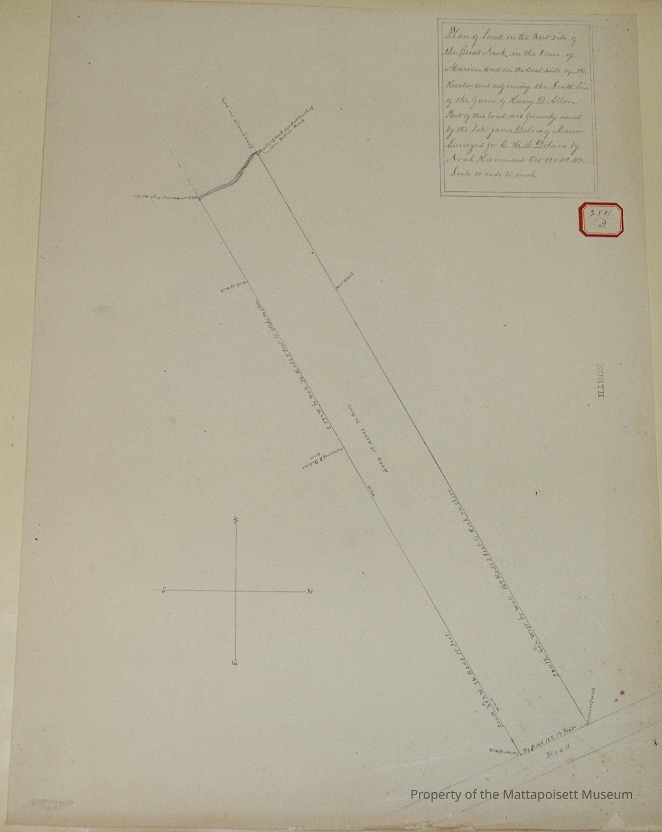
0000.5.284Scope and Content
Plan of land on the west side of Great Neck, in the town of Marion, and on the east side of the Harbor and adjoining the south line of the farm of Henry D. Allen. Part of this land was formerly owned by the late James Delano of Marion. Surveyed for C. H. L. Delano by Noah Hammond October 9th and 10th 1890. Scale 10 rods to the inch. Area 19 acres and 70 rods. On the road.Acquisition
Accession
0000.5Acquisition Method
GiftLexicon
Nomenclature 4.0
Nomenclature Primary Object Term
BookNomenclature Sub-Class
Other DocumentsNomenclature Class
Documentary ObjectsNomenclature Category
Category 08: Communication ObjectsLOC Thesaurus for Graphic Materials
Land, WaterfrontsSearch Terms
Real Estate, Great Neck, Marion, MA, Marion Harbor, Noah Hammond surveyorArchive Details
Date(s) of Creation
1890Archive Notes
Publication Notes: 1890Other Names and Numbers
Other Numbers
Number Type
Other NumberOther Number
284bRelationships
Related Person or Organization
Person or Organization
AllenPerson or Organization
DelanoGeneral Notes
Note
Notes: Notecard:
Delano, James (284B)
Part of a lot of land on west side of Great Neck - Marion
1890
Status: OKCreated By
admin@catalogit.appCreate Date
December 16, 2014Updated By
admin@catalogit.appUpdate Date
August 28, 2021