Name/Title
BookEntry/Object ID
0000.5.293Scope and Content
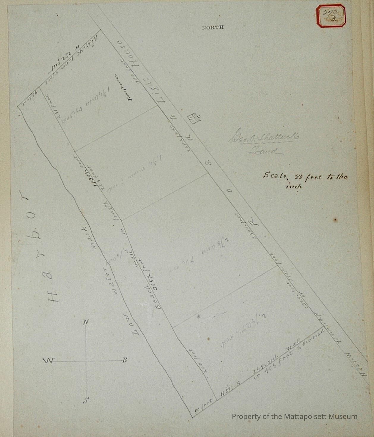
George O. Shattuck land between harbor and Road to Light House. Scale 80 feet to the inch. Divided into four, #1. 2 1/8 acres and 7 ½ rods, #2. 2 7/8 acres and 7 ½ rods, #3. 1 ¾ acres and 1 rod, #4. 1 ¾ acres and 5 ½ rods (Henry Warren).Acquisition
Accession
0000.5Acquisition Method
GiftLexicon
Nomenclature 4.0
Nomenclature Primary Object Term
BookNomenclature Sub-Class
Other DocumentsNomenclature Class
Documentary ObjectsNomenclature Category
Category 08: Communication ObjectsLOC Thesaurus for Graphic Materials
Land, Land subdivision, WaterfrontsSearch Terms
Real Estate, Light House RoadArchive Details
Date(s) of Creation
1871Archive Notes
Publication Notes: 1871Other Names and Numbers
Other Numbers
Number Type
Other NumberOther Number
293bRelationships
Related Person or Organization
Person or Organization
ShattuckPerson or Organization
WarrenGeneral Notes
Note
Notes: Notecard:
Shattuck, George O. (245B & 293B)
Ned Point Light
West side of Light House Road
Later owned by Hamlin and others
Town Plot 175S by 200E
1871
Status: OKCreated By
admin@catalogit.appCreate Date
December 22, 2014Updated By
admin@catalogit.appUpdate Date
August 28, 2021