Name/Title
BookEntry/Object ID
0000.5.294Scope and Content
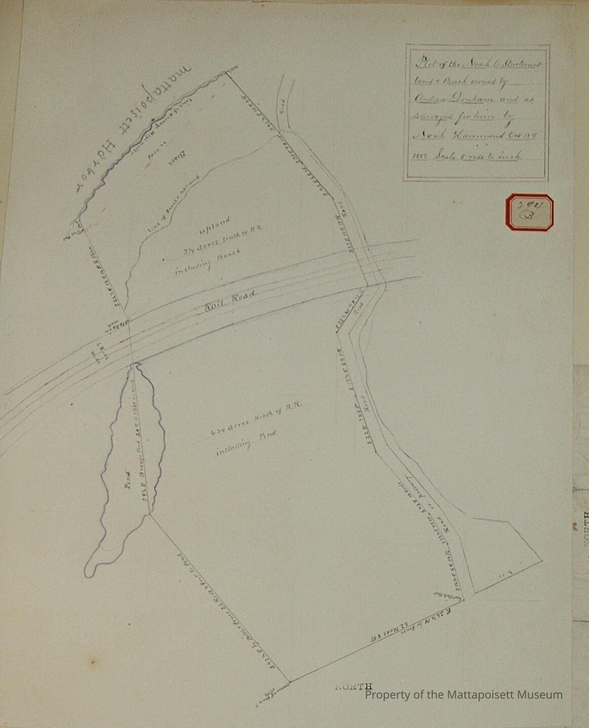
Plot of the Noah C. Strutevant land and beach owned by Andrew Denham and as surveyed by Noah Hammond October 13th, 1887. Scale 5 rods to the inch. 6 ¾ acres north of railroad including pond to the east. Upland, 3 ¼ acres south of railroad including beach. Road to Passway along west.Acquisition
Accession
0000.5Acquisition Method
GiftLexicon
Nomenclature 4.0
Nomenclature Primary Object Term
BookNomenclature Sub-Class
Other DocumentsNomenclature Class
Documentary ObjectsNomenclature Category
Category 08: Communication ObjectsLOC Thesaurus for Graphic Materials
WaterfrontsSearch Terms
Real Estate, Noah Hammond surveyorArchive Details
Date(s) of Creation
1887Archive Notes
Publication Notes: 1887Other Names and Numbers
Other Numbers
Number Type
Other NumberOther Number
294bRelationships
Related Person or Organization
Person or Organization
DenhamPerson or Organization
SturtevantGeneral Notes
Note
Notes: Notecard:
1. Denham, Andrew (294B)
Land and beach at Head of Harbor
Bought of Noah C. Sturtevant.
Town Plot 75S by 250W
1887
2. Sturtevant, Noah C. (294B)
Land and Beach at Head of Harbor
Later owned by Andrew Denham
Town Plot 75S by 250W
1887
Status: OKCreated By
admin@catalogit.appCreate Date
December 16, 2014Updated By
admin@catalogit.appUpdate Date
August 28, 2021